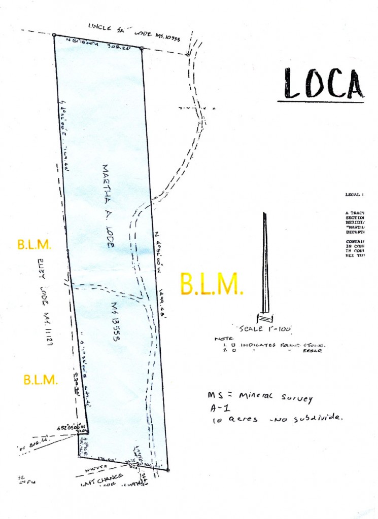
We are doing our research. Teller County and the realtor furnished a few documents; here are 2 images that further describe the Martha A lode. (Hint: Clicking the images will bring up a larger version of them.)
The “Last Chance” borders the Martha A to the south, and the “Uncle Sam” to the north. The part we are concerned with is the BLM land to the south-east; the access road to the lot crosses BLM land and we want to be reasonably sure that the BLM will not close this road to vehicular traffic. This would be unlikely, as there is a trailer (with well) on the Uncle Sam parcel, and a full-time house on the 2nd lot north, the one that borders on the Uncle Sam. (That family is the one who plows the road.) In addition, there are lots to the west of the Martha A that can only be reached from this same access road.
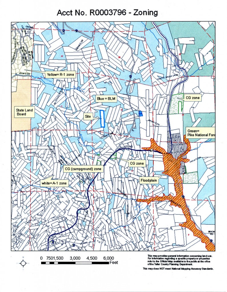
Here is a larger image of parcels in the area around the Martha A:
We are still doing our research, but have been pre-approved to make an offer. We are waiting a week so we can get current pay stubs to submitt to the credit union that would finance the transaction.
Thats it for now. Thanks for looking in!


oh my!!! that is confusing!!!!!
lol
but SO exciting!!!
will you get to see wild horses running on the blm land? would be awesome to be next to something that’s protected!
keep us updated–good luck!!! 🙂
Overlaying the survey information with satellite, terrain, and 3D imagery gives a much better idea of the property. The land is virtually surrounded by BLM land, except for Uncle Sam along the northern boundary, and Ruby & Last Chance “touching” on the west & south respectively.
Satellite photos also show a “fire lane” or access road along the southern & western boundaries of the southern half. A lot easier to survey if they were rectangles than parallelograms! Looking to the southwest towards Cripple Creek, what’s with all the overlapping surveys?