AppleAttic Blog

The Pam and Jerry Fields' Blog Page

Page 61 of 67

Riding my ATV in Ouray

This past Sunday I took my ATV (The Griz) to Ouray, Colorado. Ouray is rich in mining history and I have long wanted to explore the Jeep trails in the area. In addition to the  photos in the narrative I have included a photo gallery at the end of this post. As usual, clicking on an image will open a larger version.

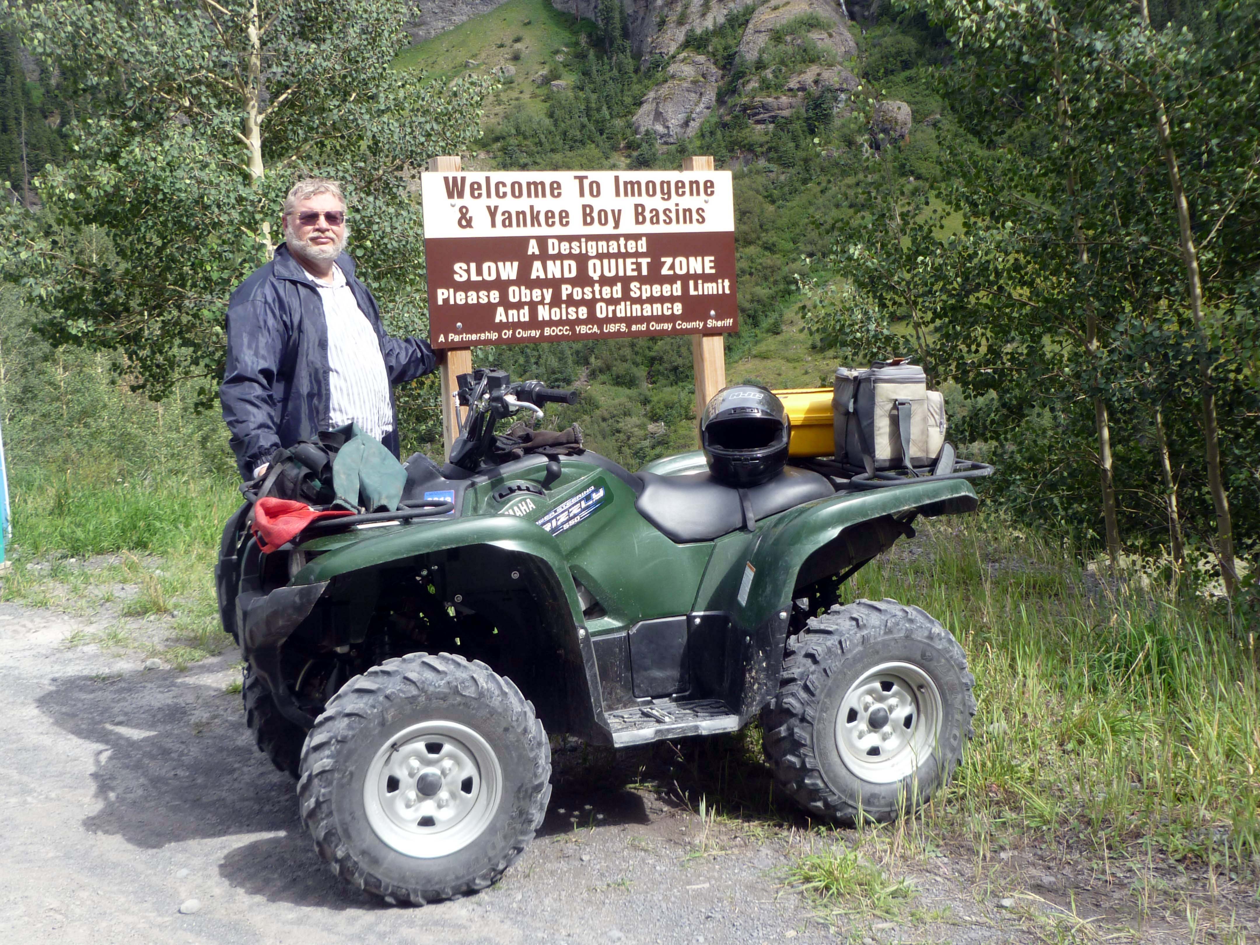
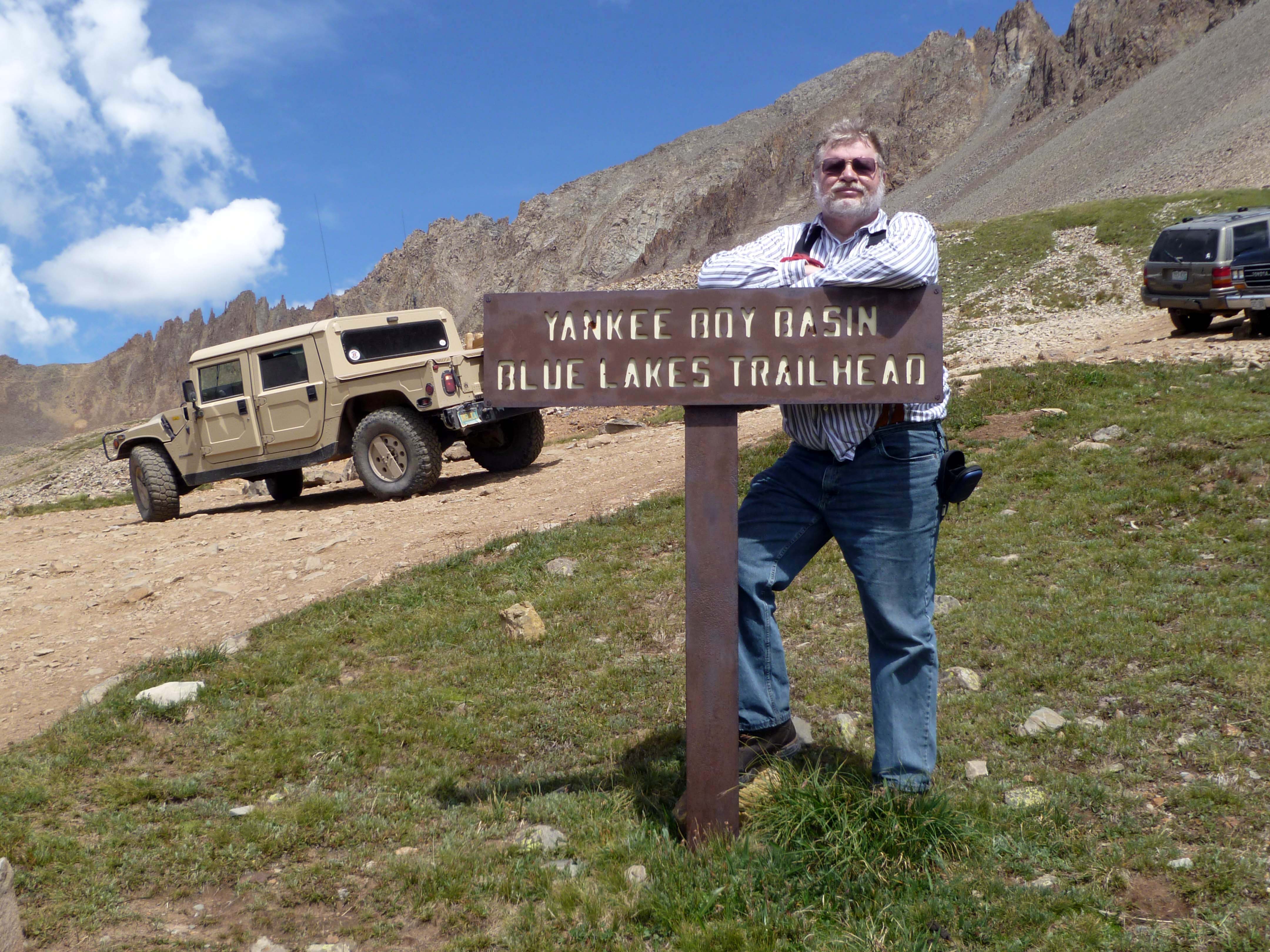
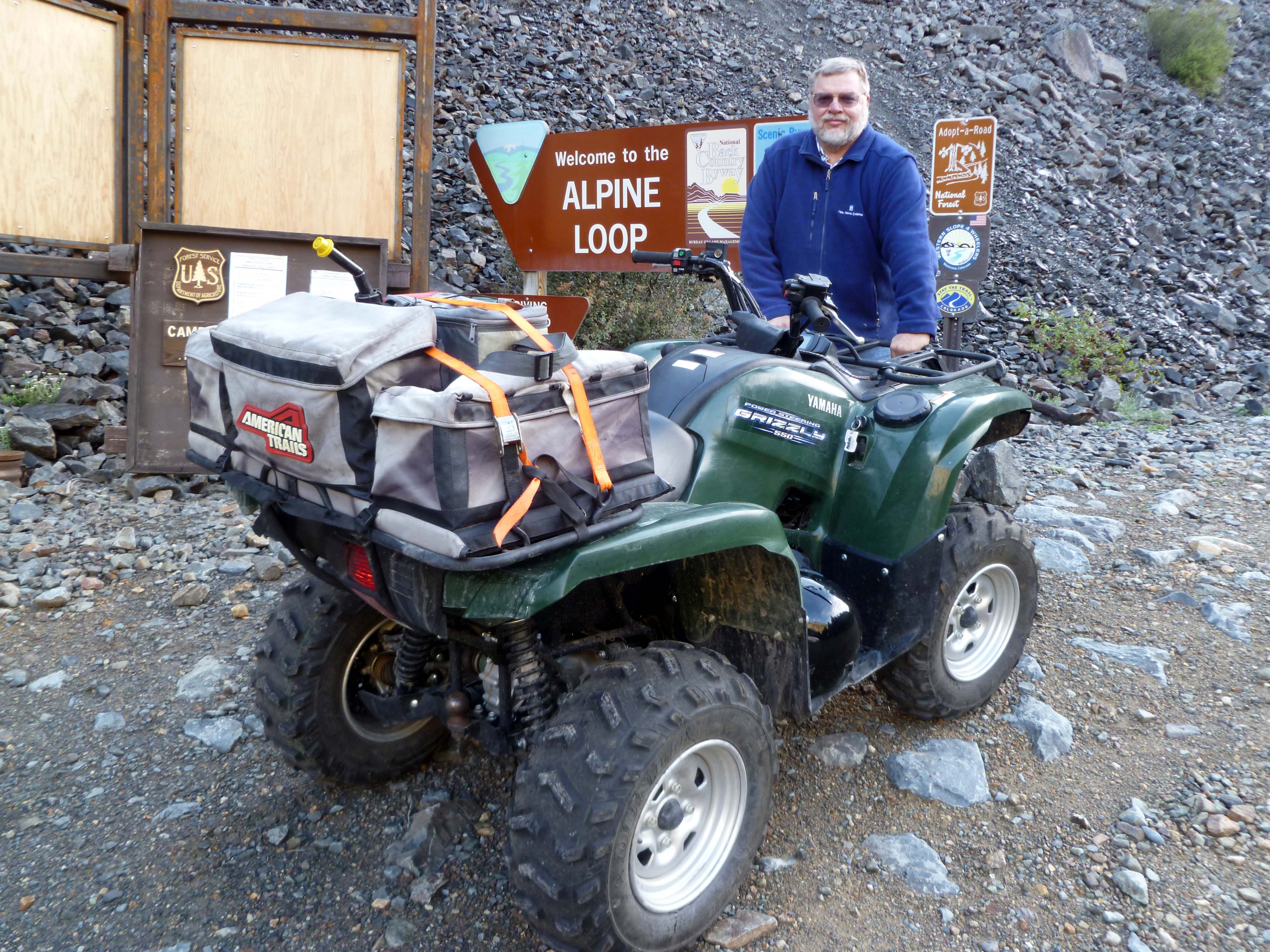
Jerry and The Griz entering the Yankee Boy Basin

There were three places I wanted to get to on this trip: Yankee Boy Basin, Governor Basin, and Imogene Pass. I had looked at my maps and planned to visit Yankee Boy Basin first then work my way back through Governor Basin and Imogene Pass. This would put me closest to the parking area at the end of my ride.

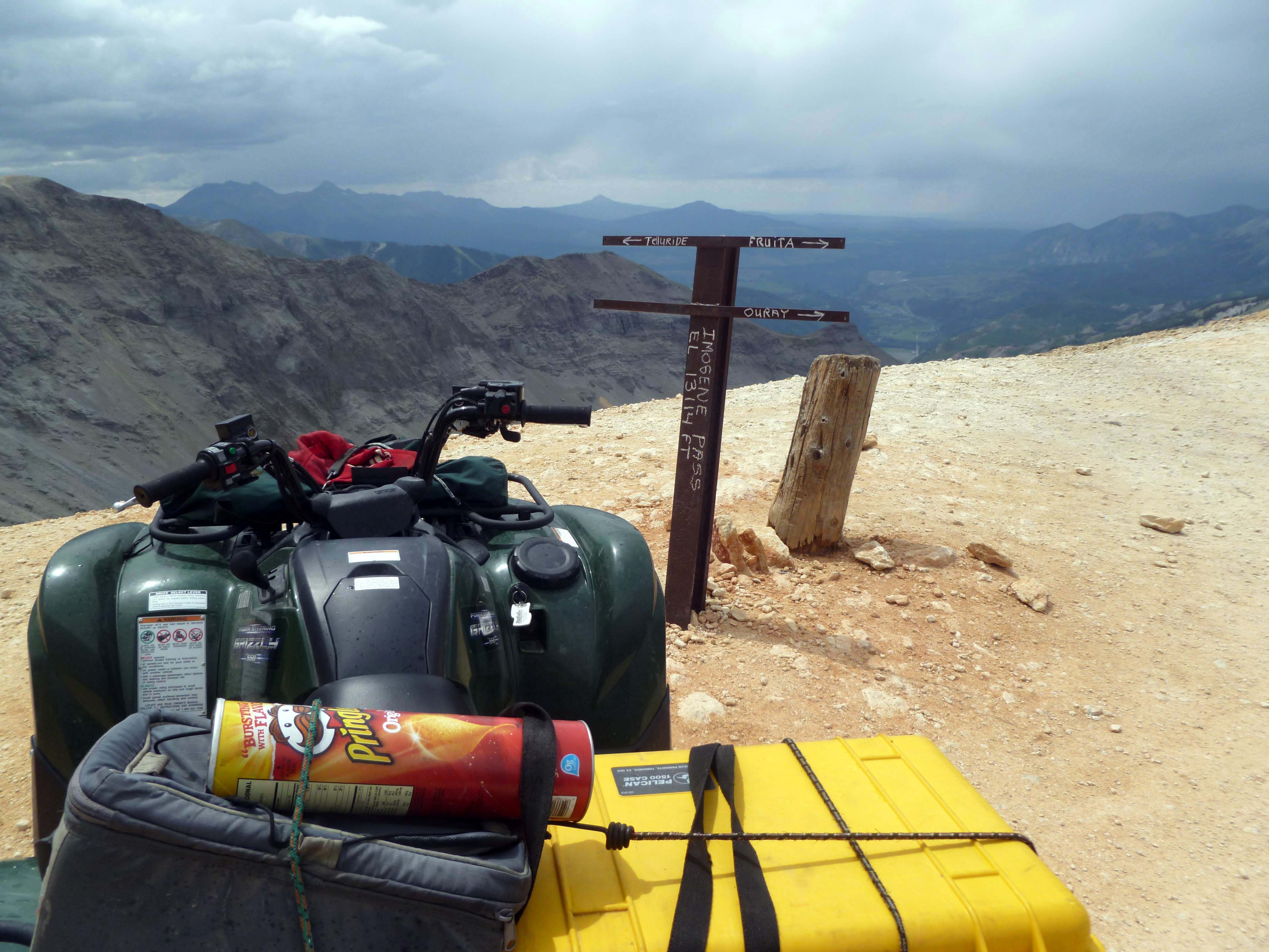
Note: Gear on The Griz included a grey soft cooler carrying beverages and lunch and a yellow camera case on the rear rack. My tripod (in a green sleeve,) baseball cap, and small carry-all bag are on the front rack. My helmet sits on the seat.

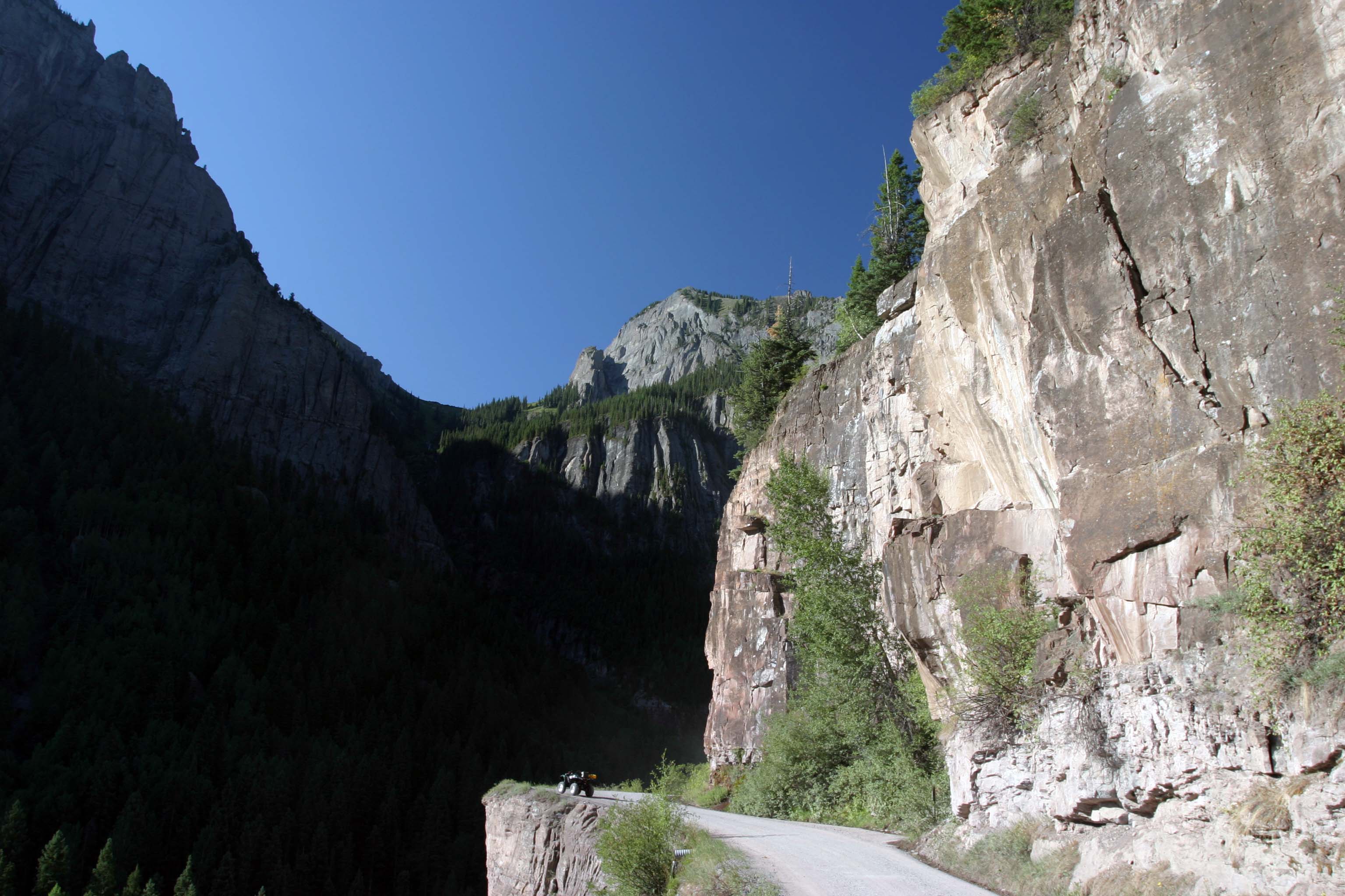
The day dawned bright and sunny but with a chance of afternoon showers. I unloaded The Griz and started up the road to Yankee Boy Basin. Due to mining activity that continues in this area, mostly for gold and silver, the lower part of the road is in good condition and can be traveled by passenger cars. It quickly becomes a shelf road, though,  narrow and with little room to pass. Here is The Griz at a popular photo spot:

The Griz at a wide spot in the road to Yankee Boy Basin.

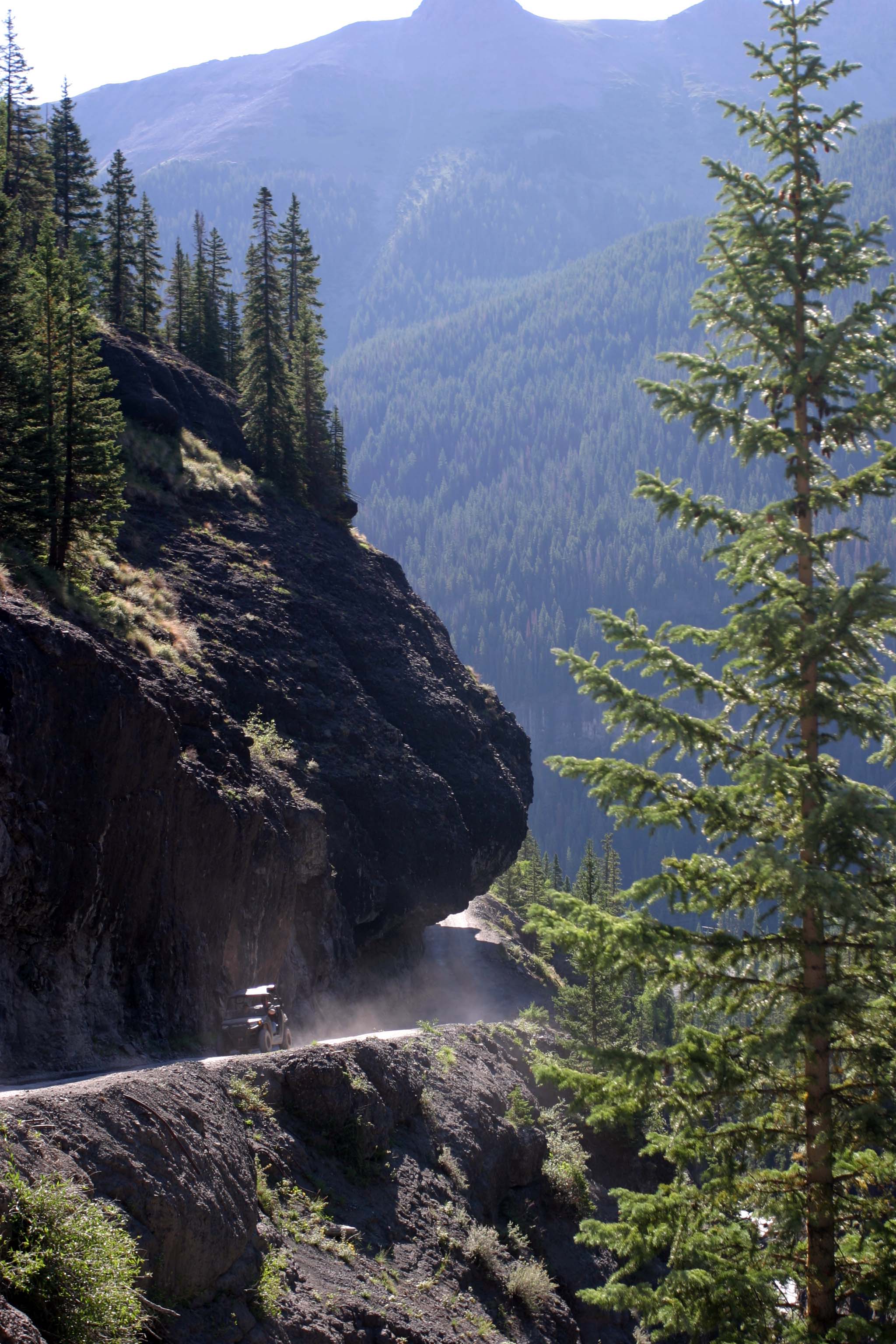
Not much further up the road you come to The Overhang where the road passes below a large rock outcrop.

Road goes under “The Overhang.”

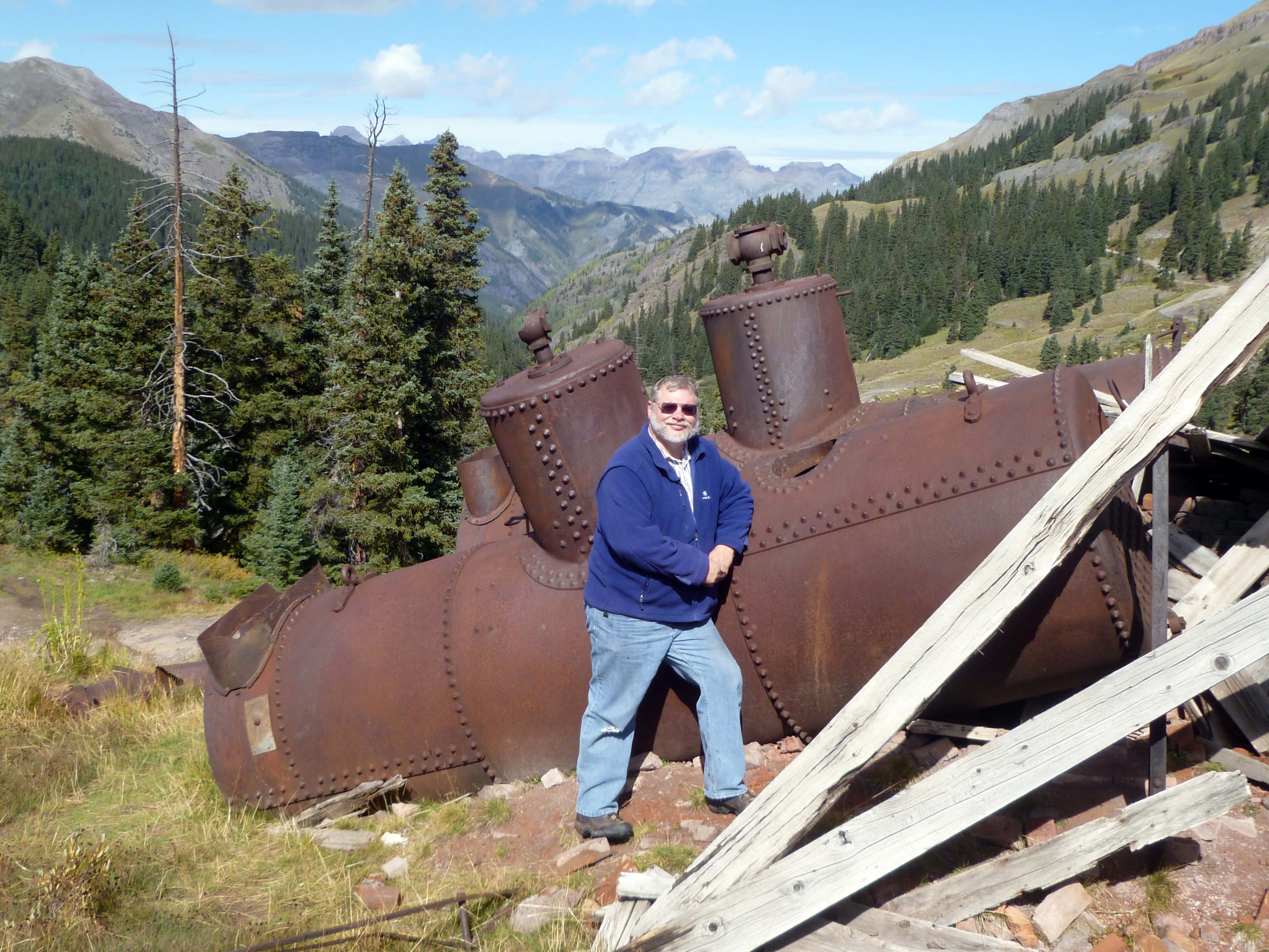
Very shortly you start seeing remains of the large mines and ore milling operations that operated in the area. Most date from the 1870s into the early 1900s. Here and there a few bits and pieces of buildings and equipment remain. Much of this is on private land and cannot be approached for a closer view. Take a look at the photo gallery to see some of  these remains.

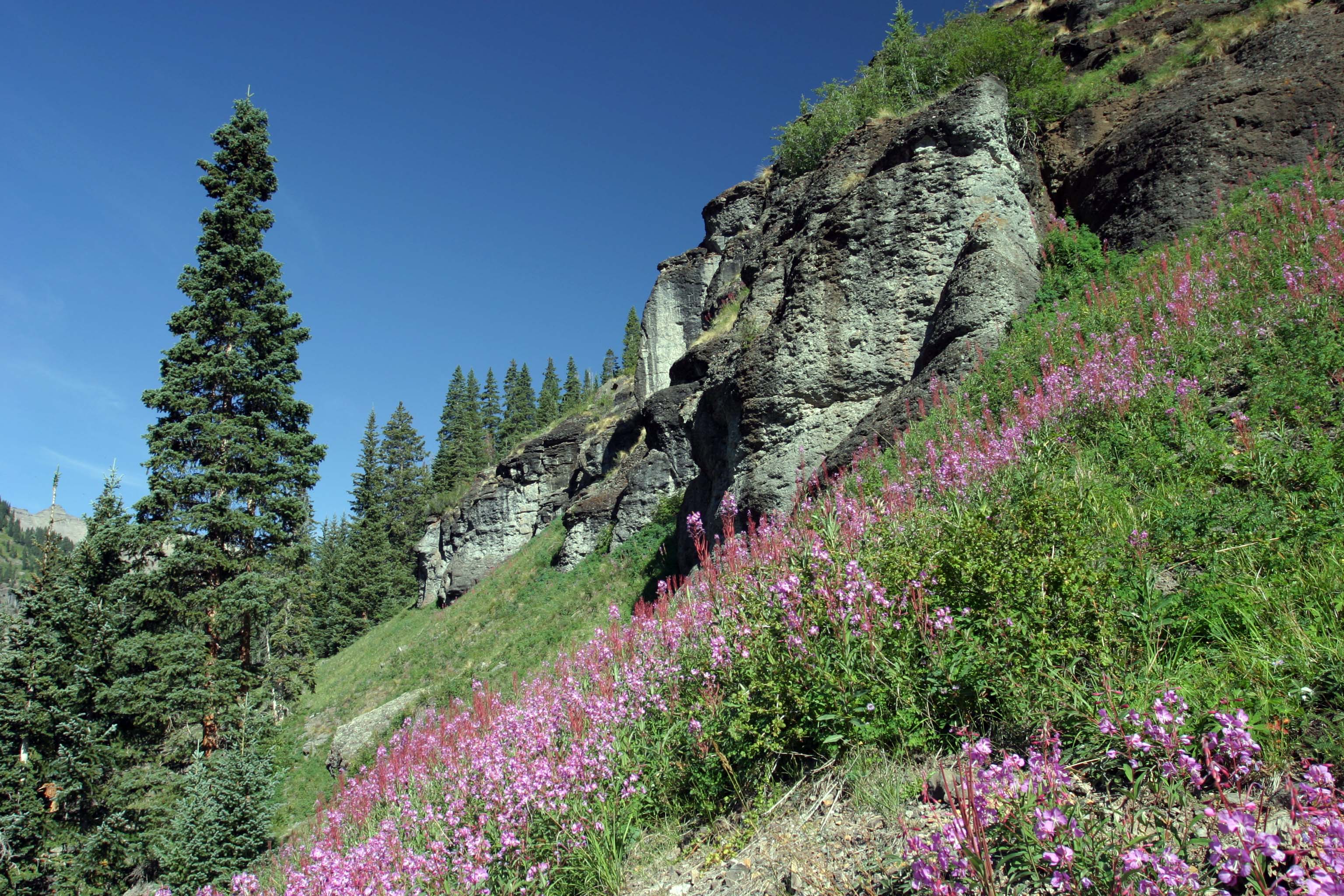
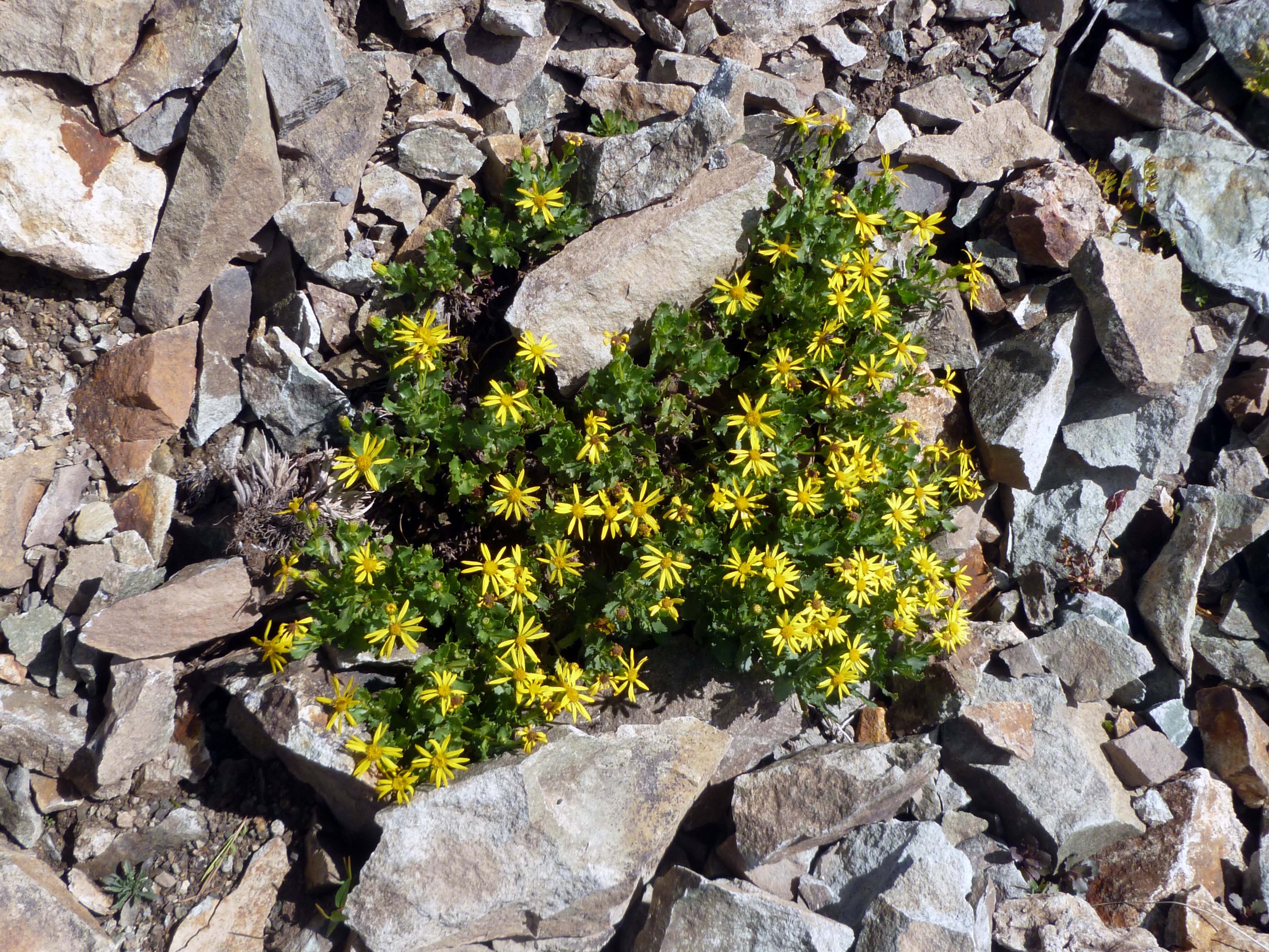
I will say that wildflowers in the area were blooming in some profusion. I don’t know the names of these flowers near the Torpedo Eclipse Mill but they sure looked great!

Summer flowers near the Torpedo Eclipse Mill.

I worked my way up the valley and eventually arrived at the top of Yankee Boy Basin. From here a couple hiking trails take off including one that goes to the top of Mt. Sneffels, one of Colorado’s “fourteeners.” (Fourteeners are peaks that are over 14,000 feet in elevaton.)

End of the road, Yankee Boy Basin.

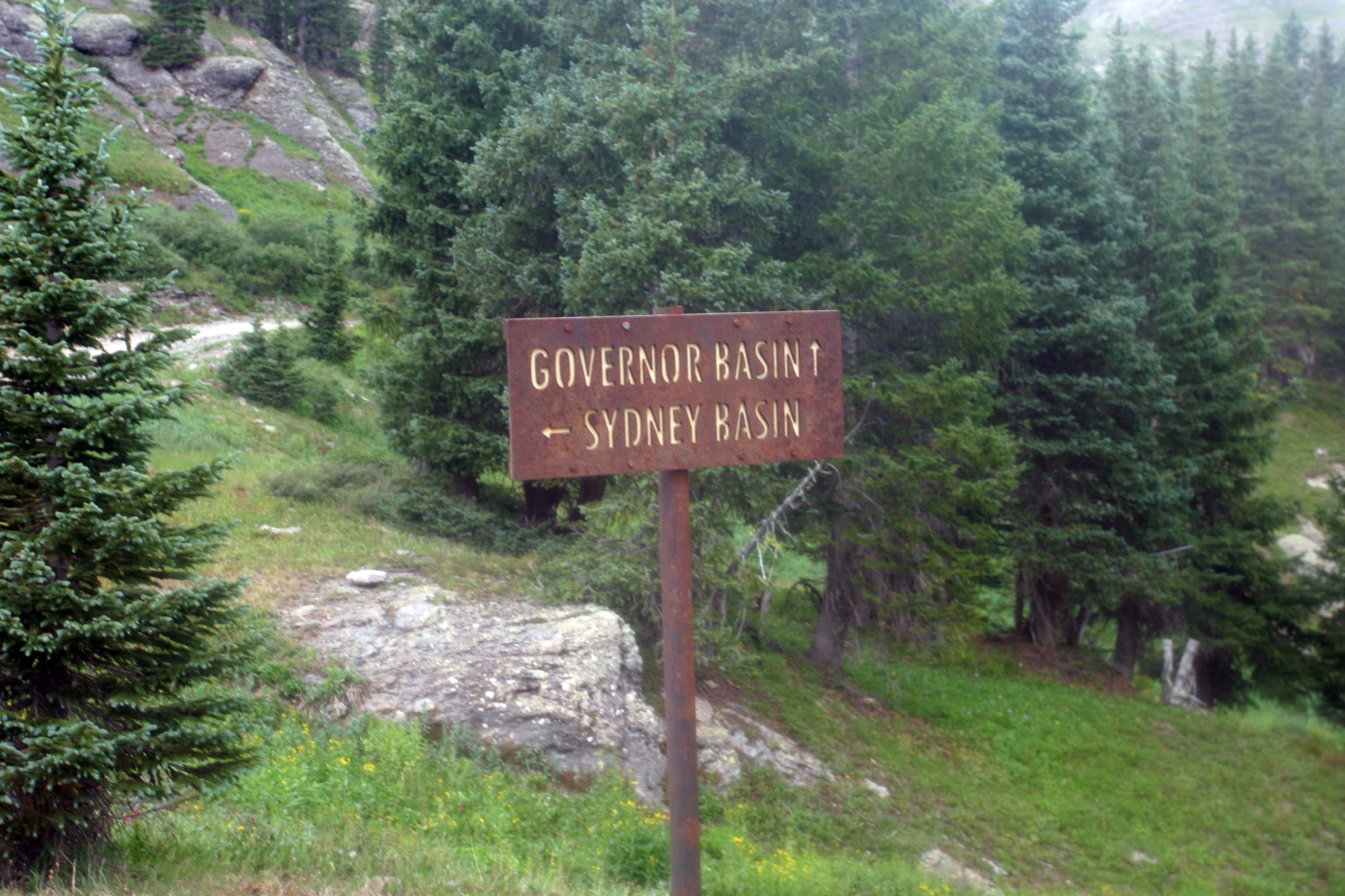
Objective #1 for the day met, I backtracked down to the turn off to Governor Basin. Similar to Yankee Boy Basin, the Governor Basin area was rich in gold and silver deposits.

Governor Basin route sign. It was getting overcast by now.

Old mine tailings dot the area. One mine had a modern bucket loader and compressor parked near the mine entrance and the entrance road was blocked by a locked gate, all indications the mine is currently being worked. The guide book I was using listed this mine, the Mountain Top Mine, as being open to visit but obviously things have changed in the last 2 years since publication. Not unusual given the rise in the price of gold. A couple other mines showed similar activity. Many of the claims in the area are privately held and periodically worked.

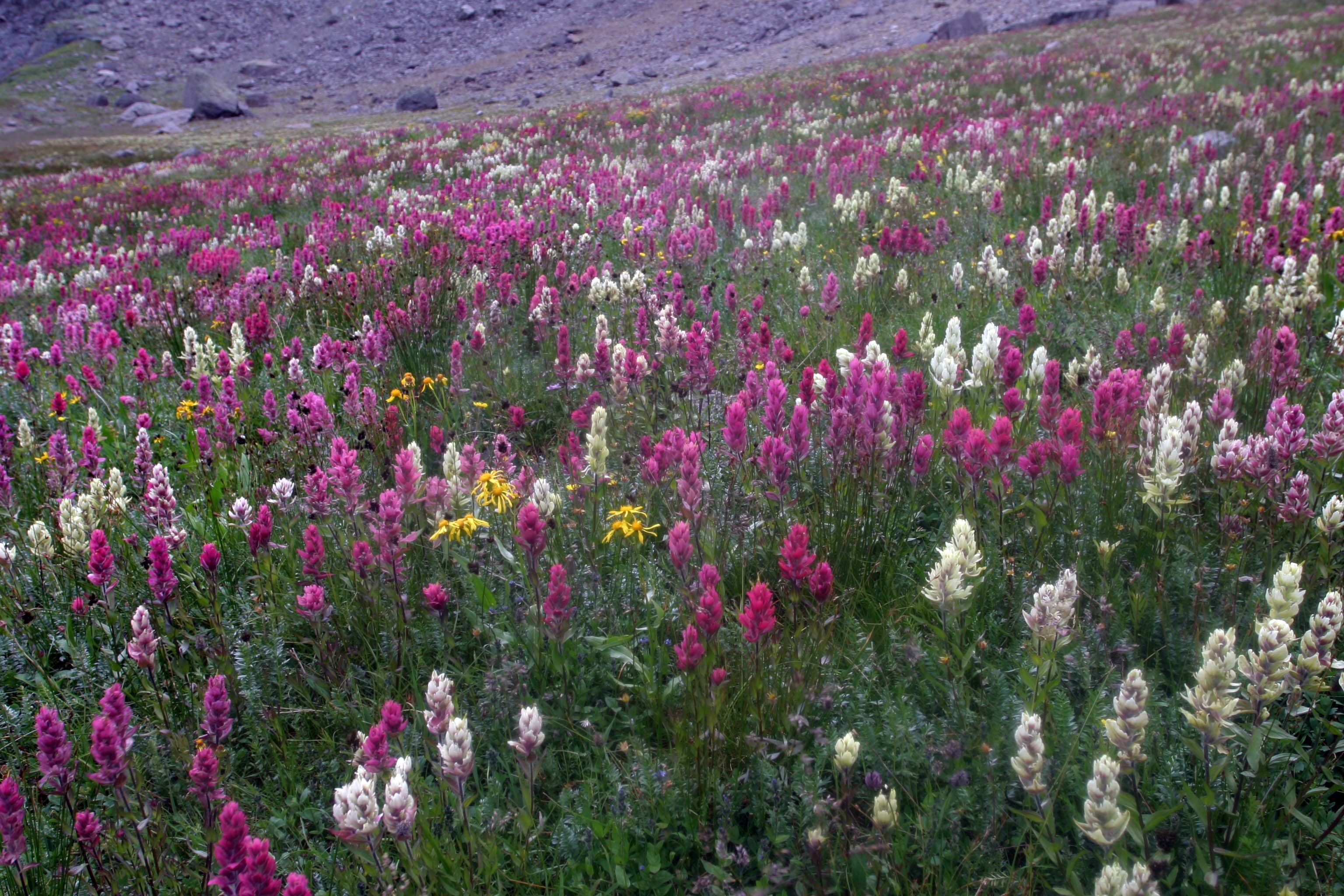
Wild flowers in this area, which is above timberline, were great. Although the sky was getting dark the flowers were still vibrant. Here is one of the meadow areas I passed.

Wild flowers carpeted the meadows in Governor Basin

With objective #2 met I headed back toward the turn-off for Imogene Pass. On the way down it started to rain lightly. By the time I made it to the turn for Imogene Pass it was raining moderately hard.

The road – more like a trail – to Imogene Pass was the roughest trail of the day. Later I found out why: The better road goes through a mining property and  is often gated. The “alternate” road basically follows a power line  easement. I came back on the better road as, on this weekend, the gates were open.

I stopped and put on my windbreaker in an attempt, mostly sucessful, to stay dry and continued up the trail. I counted on the rain stopping a bit later as that is the pattern of mountain storms, and eventually the rain did stop and the sun returned although filtered by a few remaining clouds.

I have to get back here again. There are numerous waterfalls along this route and I did not get to take them all in. (The route to Yankee Boy Basin also had waterfalls; you can see  photos of them in the gallery.)

I made it to the top of the pass, looked around, and headed back down. It was getting late in the afternoon and I wanted to look over some mine ruins I had passed on the way up and find a place to eat a late lunch.

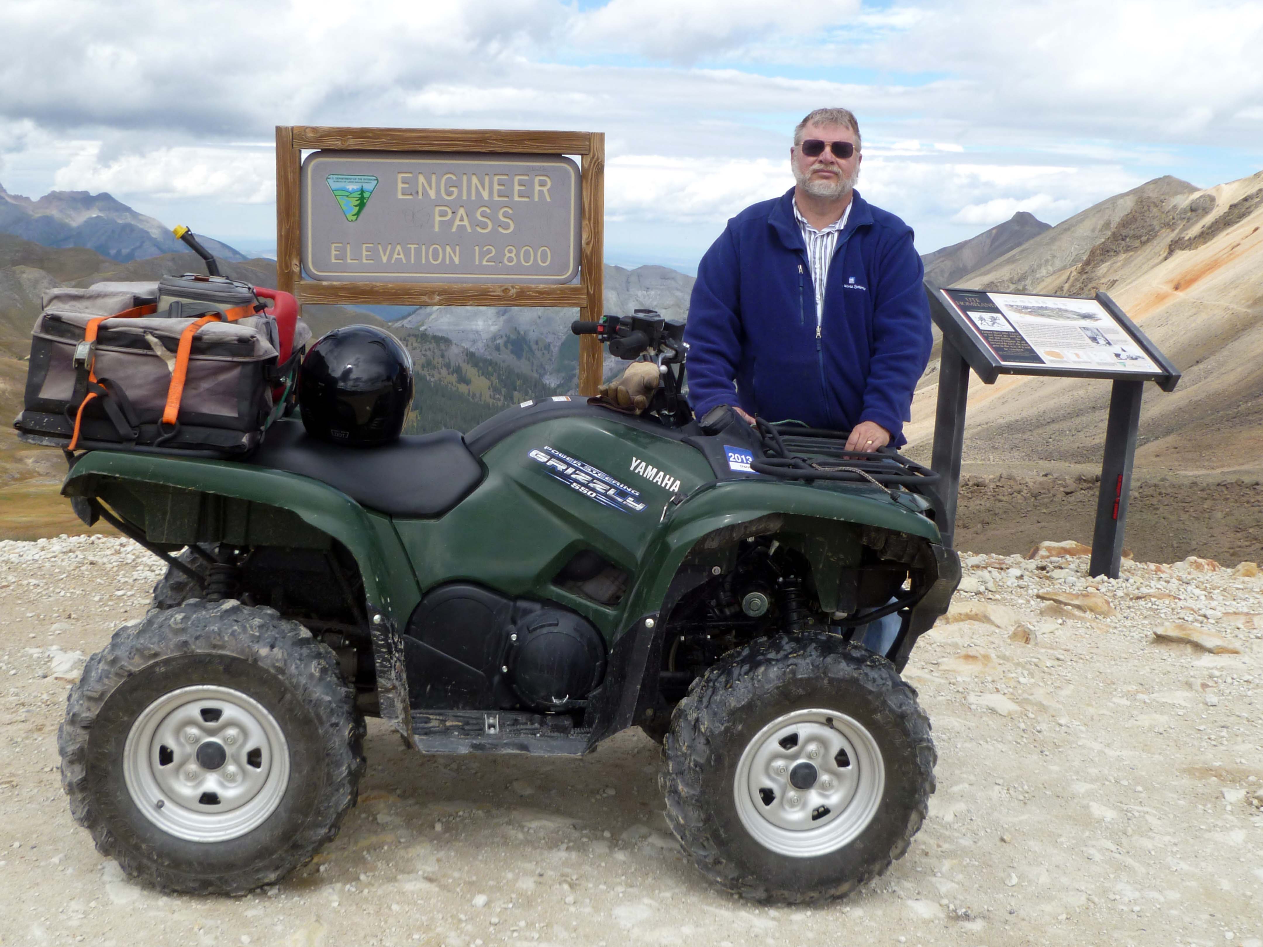
The Griz at Top of Imogene Pass

The Griz at Top of Imogene Pass

Although I was now drying out and had enjoyed myself a great deal, it was time to head back to the car and pack up up for the trip home. On the way back to the parking lot my phone buzzed indicating I was back in cell phone coverage. I had a call from Pam: Our land offer had been accepted!  That was a great delight to hear.

I got back to the parking lot, loaded The Griz, and headed out for the 2.5 hour trip back to DeBeque. I was very tired when I arrived home even though I had only ridden about 40 miles total. With all my photo stops and lunch this back woods trip worked out to an average speed of 5 miles per hour. Much of the trip was done in low-range 4-wheel drive giving me about 15 miles-per-gallon fuel economy.

I really enjoyed this outing. The afternoon rain made for less than ideal photo opportunities and I would like to get back to shoot some better photos. There are other routes in the area to ride as well. I could spend several days here and not get to all the trails shown on the back country maps.

Although the area is remote it is popular for Jeep tour operators and off-road folks. I saw dozens of Jeeps, ATVs, UTVs (those are the side-by-side rigs that look like overgrown golf carts) mountain bikers, both pedal type and motorized variety, and hikers. Lots of help around in case of a breakdown or other problems. The roads were better than I expected except for Imogene Pass. High country trails, flowers, waterfalls, mining history…my kind of trip. It was a good day!

Normally I carry just my little point-and-shoot Panasonic camera. This time I carried an older Canon digital camera equipped with a mild zoom lens as well. It has been a while since I dealt with F-stops and shutter speeds, but I want to have more creative control over my photos and the Canon seems a good way to get there. There are photos from both cameras in the gallery. Although the Canon EOS 10d  is rated at only 6.3 megapixels, low by today’s standards, for web photo use it should be OK.

WordPress plugin

That’s it for now. Thanks for looking in!
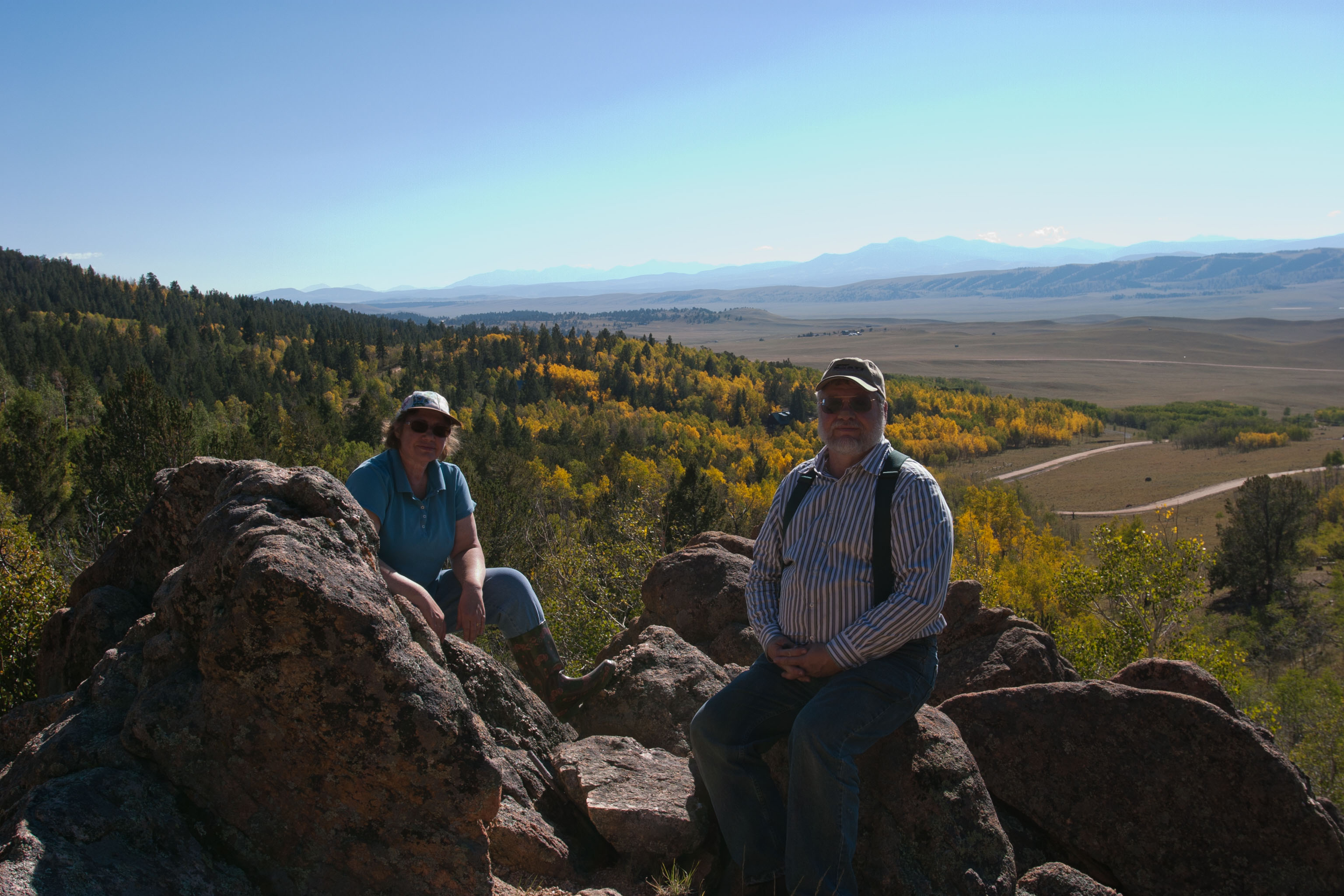
And the answer is …Yes!

What a couple of days.

We made an offer. The seller made a counter offer. We made a counter offer. The seller agreed to to our  offer, but made a change in the contract to split part of the closing costs. We didn’t know how much this was until today (Monday) and it turns out our half would not exceed $90.00. For this we needed a new contract? Given the new information we signed the dotted line. Closing is tentatively set for September 14, depending on how fast the bank can process our loan application.

What a relief! Now our planning can start “for real.”

Speaking of loan applications…

It has been a while since we went through the process, but it doesn’t seem to us that a loan app should be so involved. Much of the application is boiler plate as we are only buying land, but still we need pay stubs, tax returns, lists of assets (short!) and list of liabilities. We had been pre-approved but the bank (actually a credit union) could not “officially” process the paperwork until we had a signed contract. All this stuff is available through a credit report so I guess it is just a matter of the bank seeing how honest we are in filling out the forms.

Now we submit our paperwork and wait. I am off today but will take everything in tomorrow to make copies before I mail off the originals.

Happy birthday to me!

That’s it for now. Thanks for looking in!
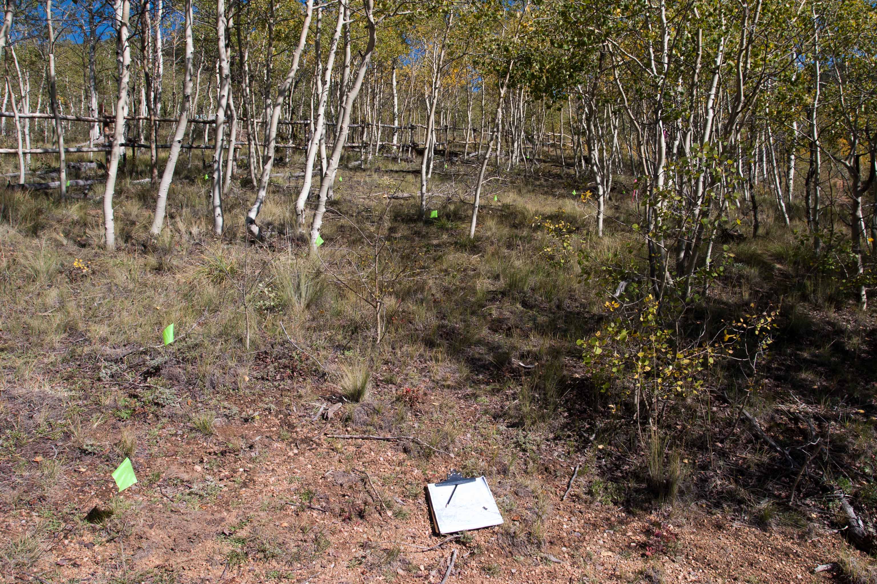
 

An answer tomorrow?

No answer to our offer yet. Seller has until 5:00 PM tomorrow (Sunday) to respond. In the mean time I did speak to a contractor about putting in a drive way.

Holy smoke!

$1,800.00 per day for equipment plus materials (culverts) that may be needed. 2 day minimum. Soooo we are looking right around 4 grand to just be able to drive onto the lot! (Not including the County’s drive way permit fee, of course.) This would not get us back to a home site or include any retaining walls or materials to build them.

High end, for all the goodies including decorative retaining walls, $12 – $15K depending on where we would identify a building site.

I am in the wrong business.

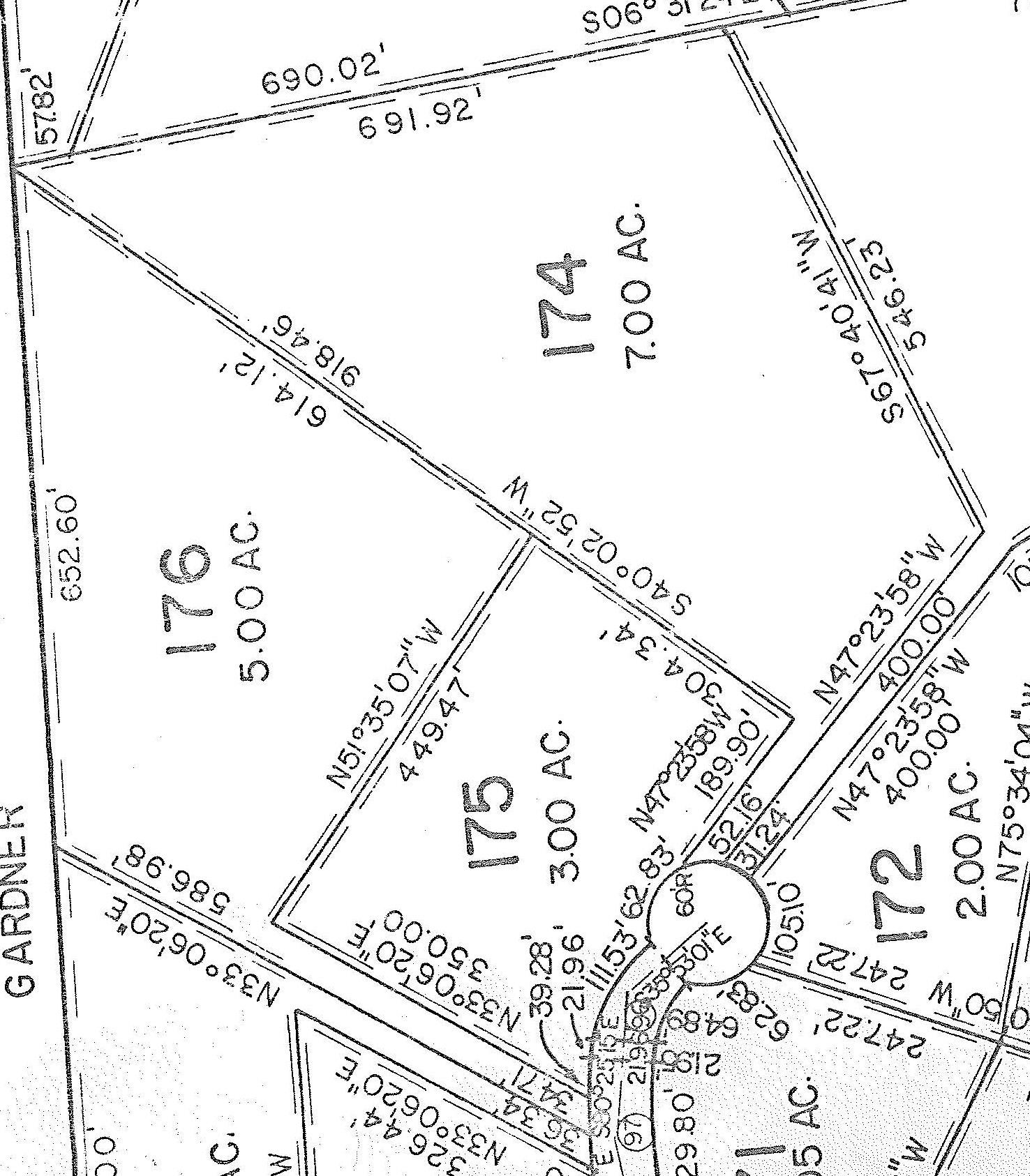
Here is a plat map of the property. Look at lot 174 which is the lot we want. This type is known as a ‘flag lot’ because the entrance to the lot looks like the pole of a flag.

Our proposed lot is number 174. Click on this image to bring up a larger version.

The drive would come off the road and make a left turn to get into the lot proper. It is this ‘pole’ entrance that makes the driveway so long. Distance from the road to the corner where the lot opens up is about 190 feet. The “52.16” is the width of the access alley, which is part of the lot and not an easement. Park County requires a 15 foot wide drive at a minimum so there would be a buffer zone between this lot and lots to the left and right.

The $4K I mentioned earlier would just get us the first 200 feet or so, from the road up to the first corner marker – the “pole” section of the lot. Depending on where we would site a house or shed the drive would have to be extended. I might be able to handle an extension with rental gear. A skid-steer loader (Bobcat) goes for about $265.00 per day. I have only 1 previous experience running a Bobcat but I think I could handle it.

The problem is that the entrance has to cut through a couple small ridges and be lowered to the height of the road, requiring an excavation of around 6 feet below surface level. I am not sure I could do it with rental gear. I may take a long probing rod along the next time and see if I can determine if the ridges are decomposed granite with some rocks in them or if there is a ridge of underlying rock. If I find the first condition I may try punching in the drive myself. If the second, then hiring a contractor would be the only way to go.

All of this is moot, of course, if the buyer rejects our offer. We will know tomorrow.

That’s it for now. Thanks for looking in!
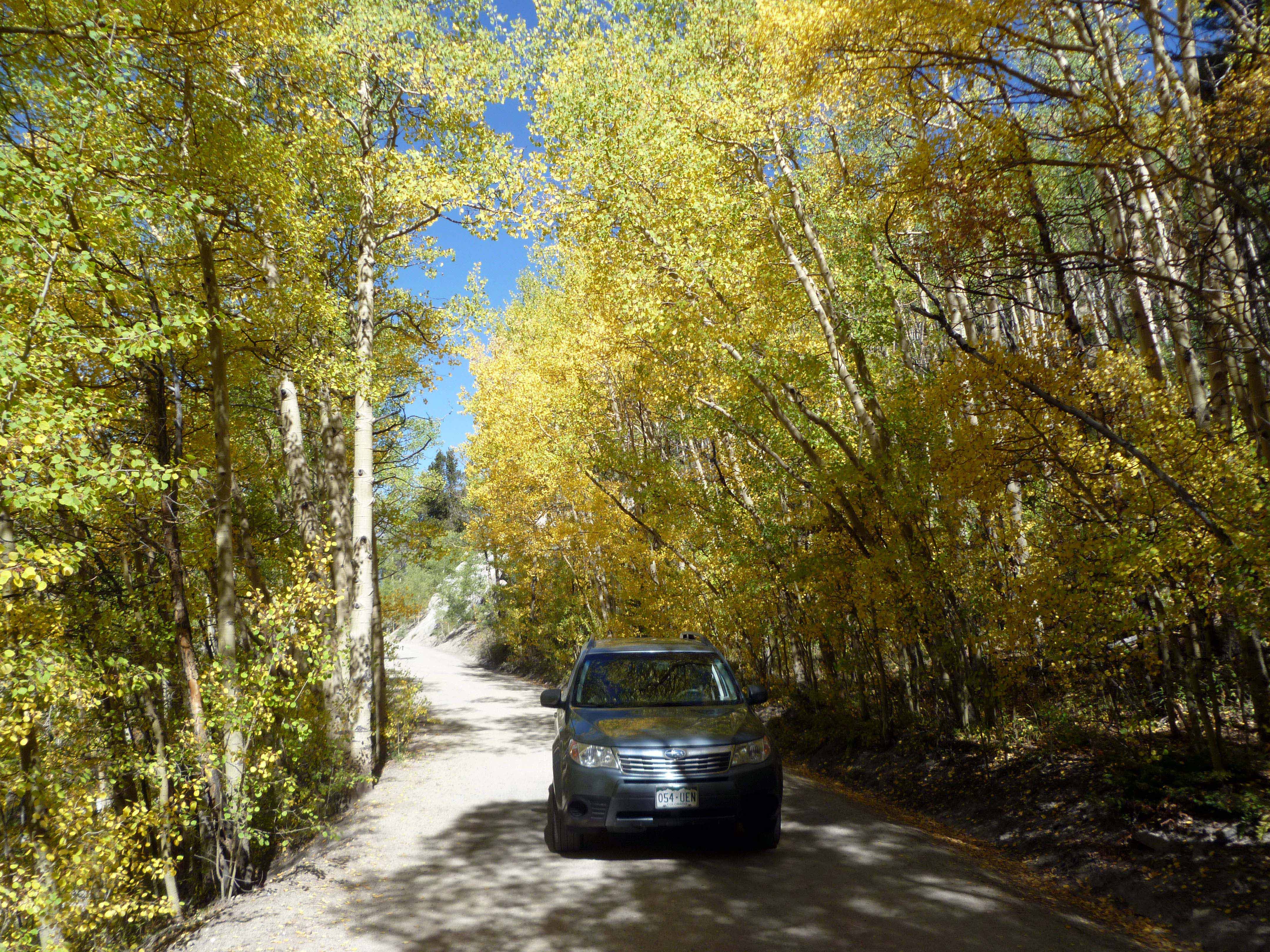
We’ve decided on a lot!

(Click on photos to open  larger images.)

Finally.

After 2 more trips in July to view properties, we have found the lot for us. We had been to this lot twice before and, after walking more of it on our 3rd visit, decided to make an offer.

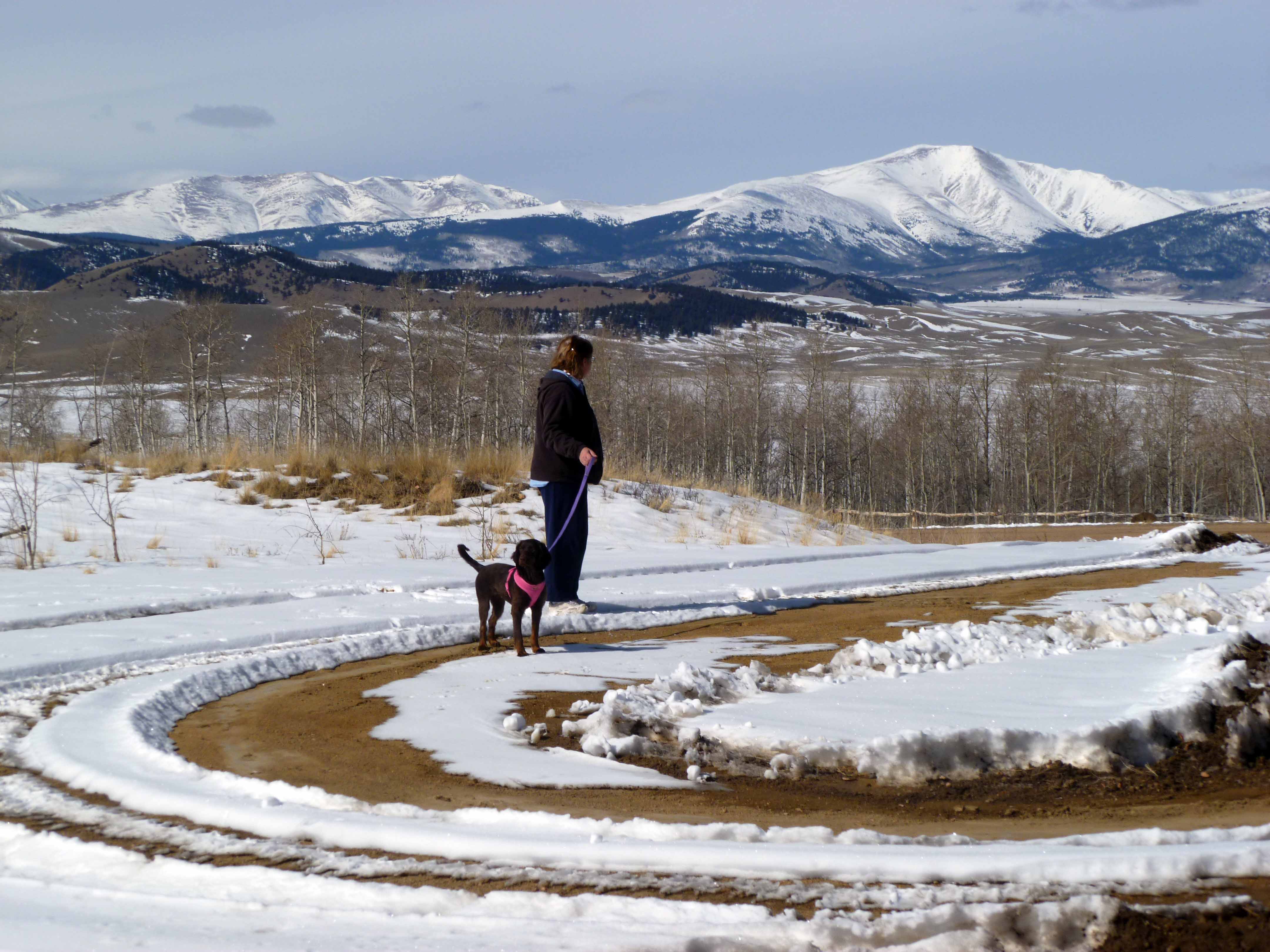
The lot is on Sanderling Court, and if that rings a bell, you may remember we first visited Sanderling and posted a couple pictures in late spring. Snow was still on the ground. (Remember snow? Frozen white stuff that falls from the sky?)

Here are what we consider the pros and cons.
Pros:
In our price range.
Access is from a county maintained road, plowed in winter.
Lots of aspen and some pine.
Lower part is fairly level and has a good building spot.
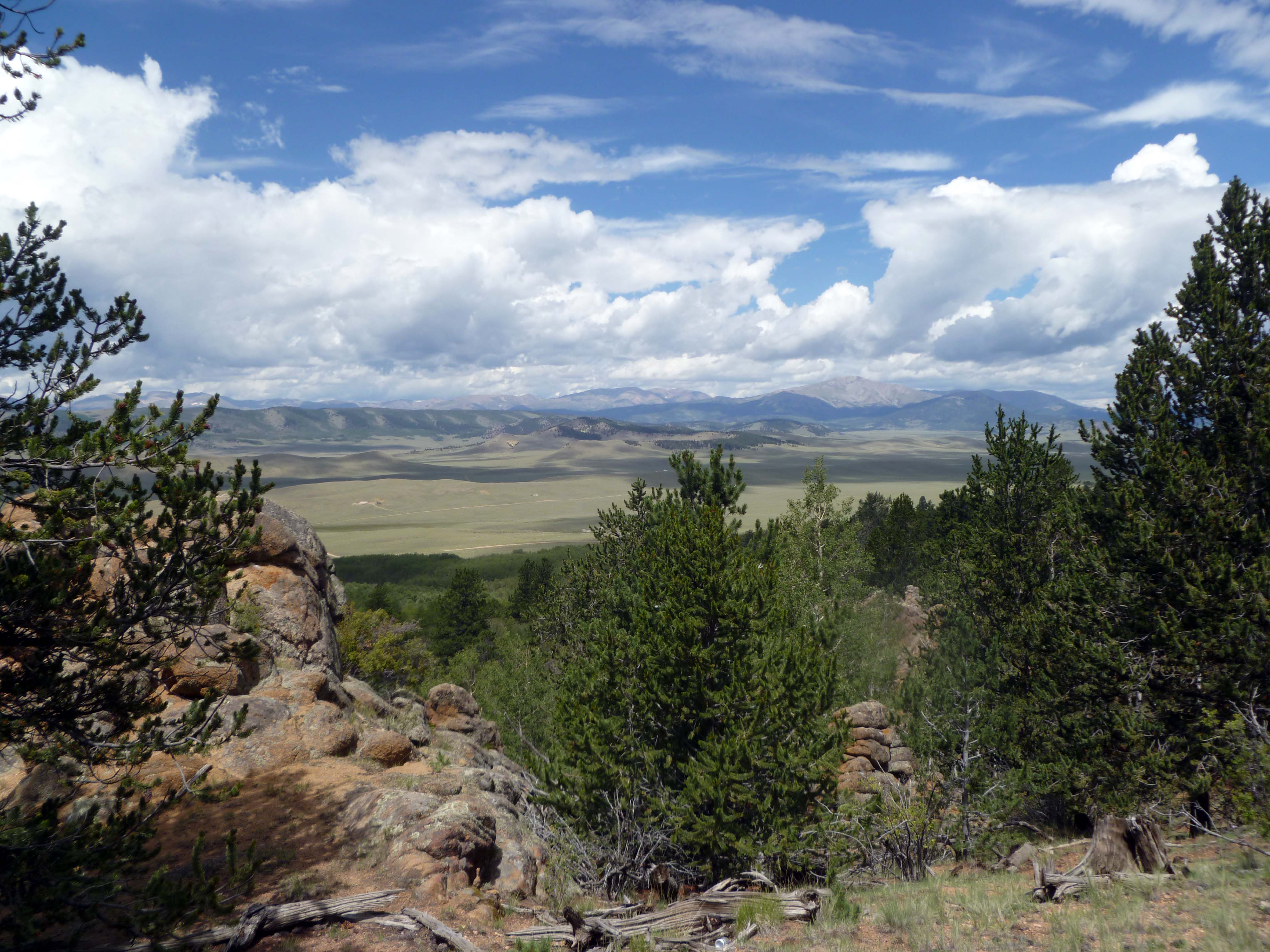
Views from upper lot are great, from house site very good, from end of driveway where it joins the county road the views are spectacular.
Lot is in a saddle between two ridges, seems protected from wind.
Quite a varity of wild grasses and flowers. No cactus!  (Seriously, some lots had cactus.)
No looking over a neighbor’s roof.
High enough to be significantly cooler in summer than at the house in DeBeque.

Cons:
No driveway into lot. I have contacted a local excavating company and am waiting on a driveway installation estimate.
Entrace to lot would go down a slope, making winter access something of a concern.
Back of the lot is s-t-e-e-p.
No cell phone coverage. (This may be a Pro, depending on how you feel about getting away from technology for a while.)
Currently open range so we would have to build some type of fence to keep roving cattle off the property.
It is a bit further out from civilization than we would like. Closest gas station or convenience store is about 20 – 25 miles away in either Fairplay (west) or Jefferson (east.)  Fire station is 6 miles away (EMTs!).
No mail delivery. Must get a P.O. Box in either Fairplay, Como, or Jefferson. Como, closest, is about 15 miles away.
Access road is gravel.

Here are a few photos of Filing #4, Lot # 174 (address is 179 Sanderling) :

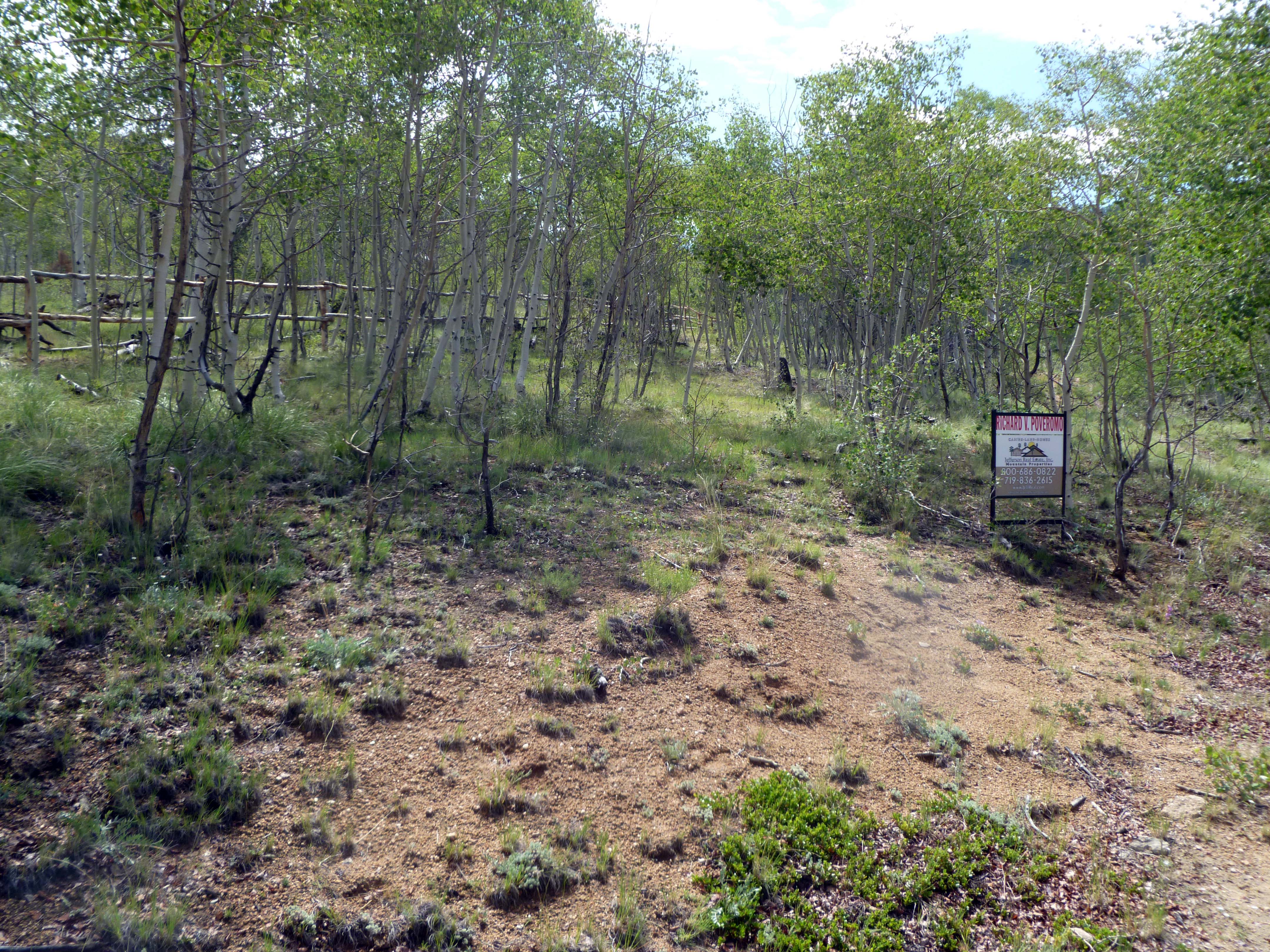
Driveway would go through here.

Driveway would go through here and pass to the left of the For Sale sign.

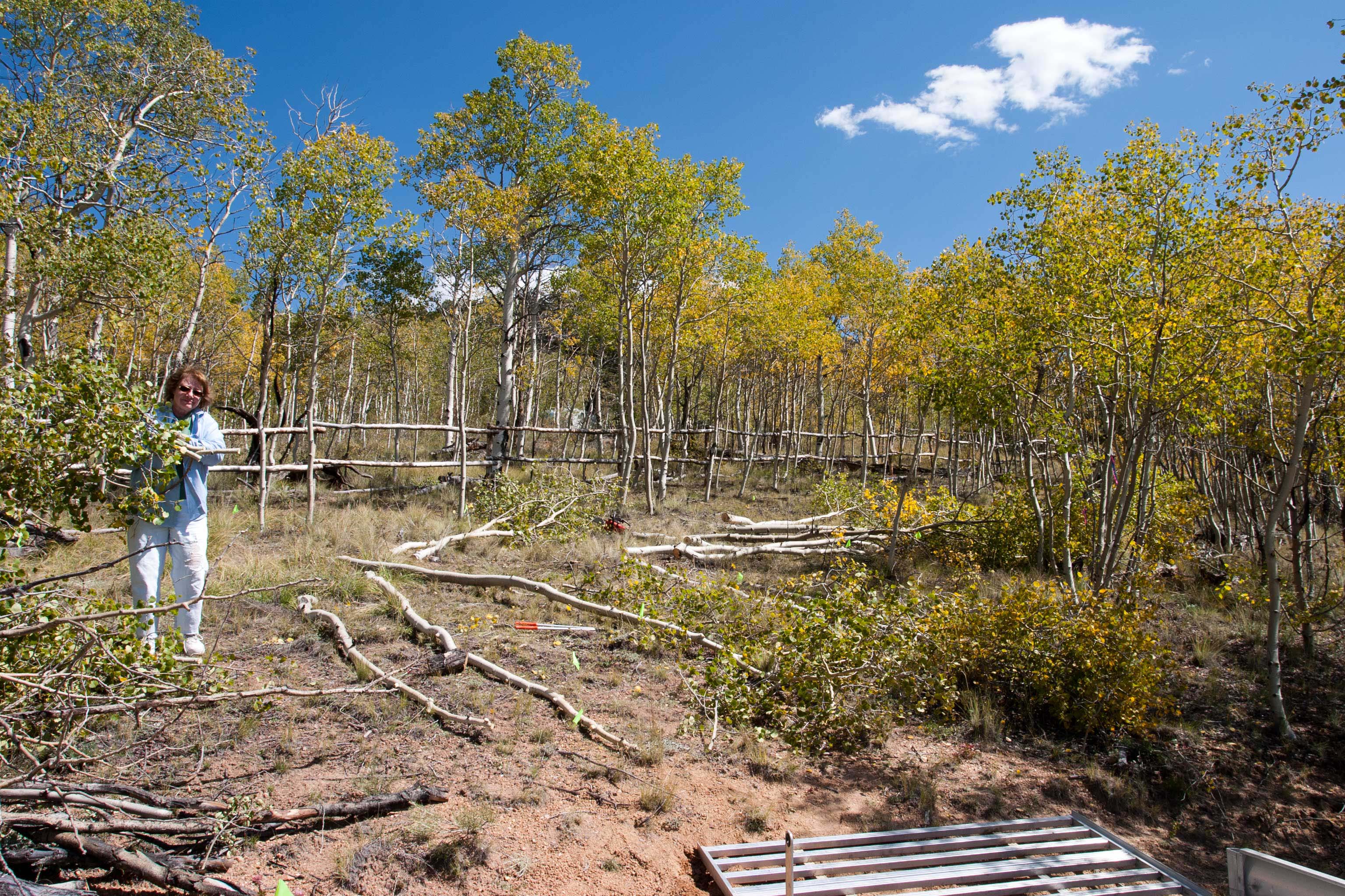
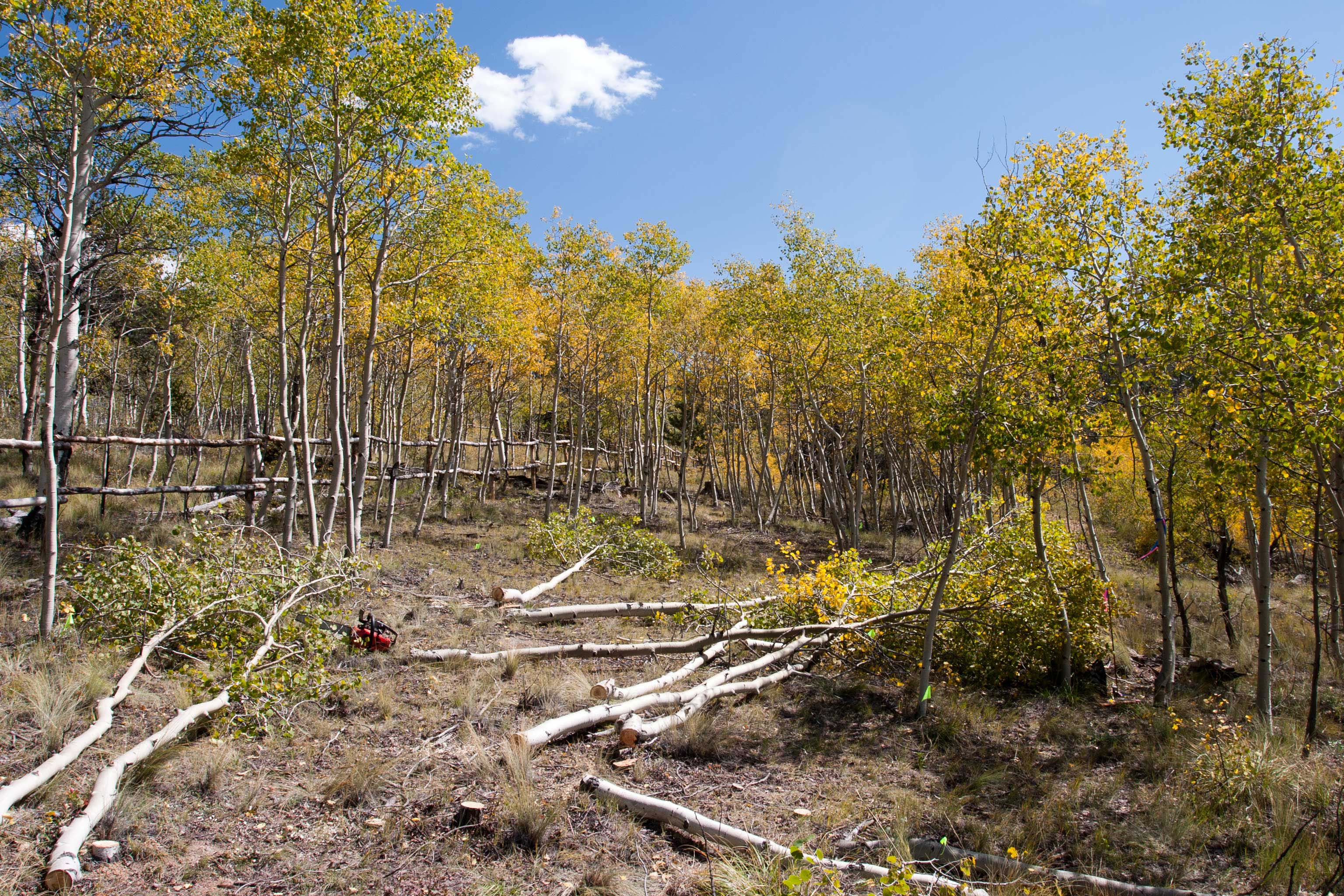
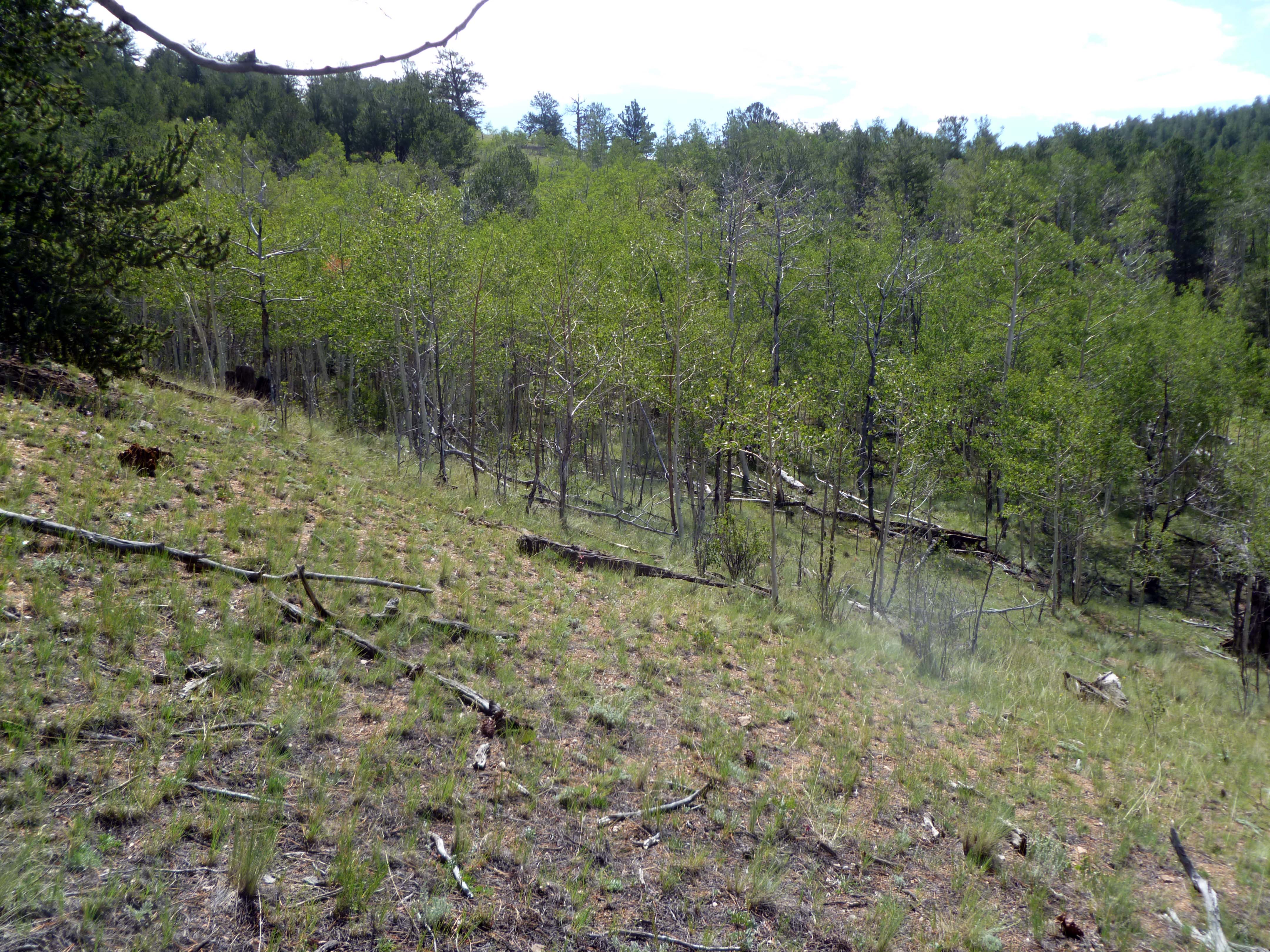
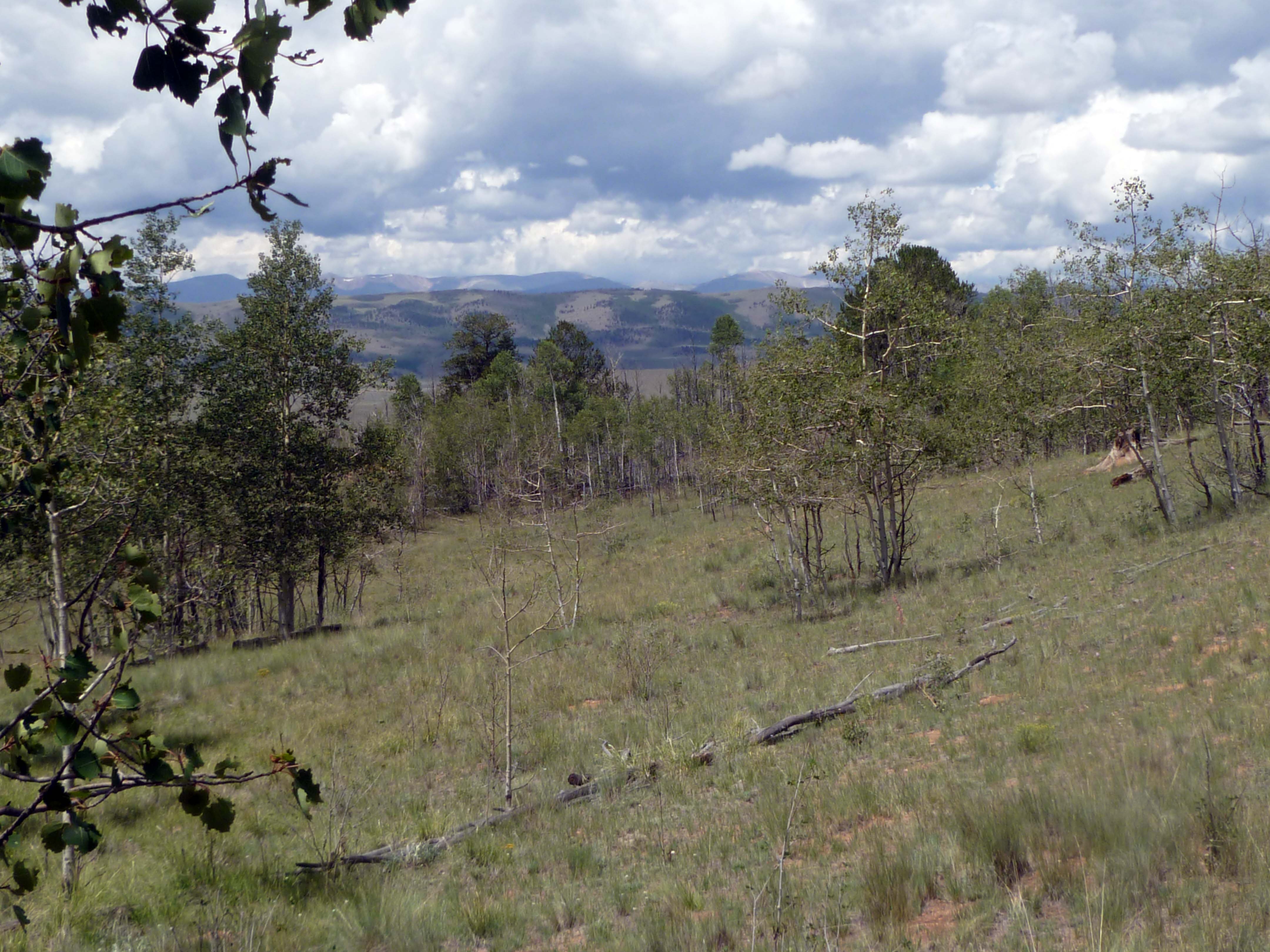
There are plenty of aspen to remove. The dead trees would become firewood. We would thin the living trees to allow for better growth for the rest.

Driveway would have to be cut into the hill at left, slope down, then curve right into the flatter part of the lot.

Slope into lot is fairly steep.

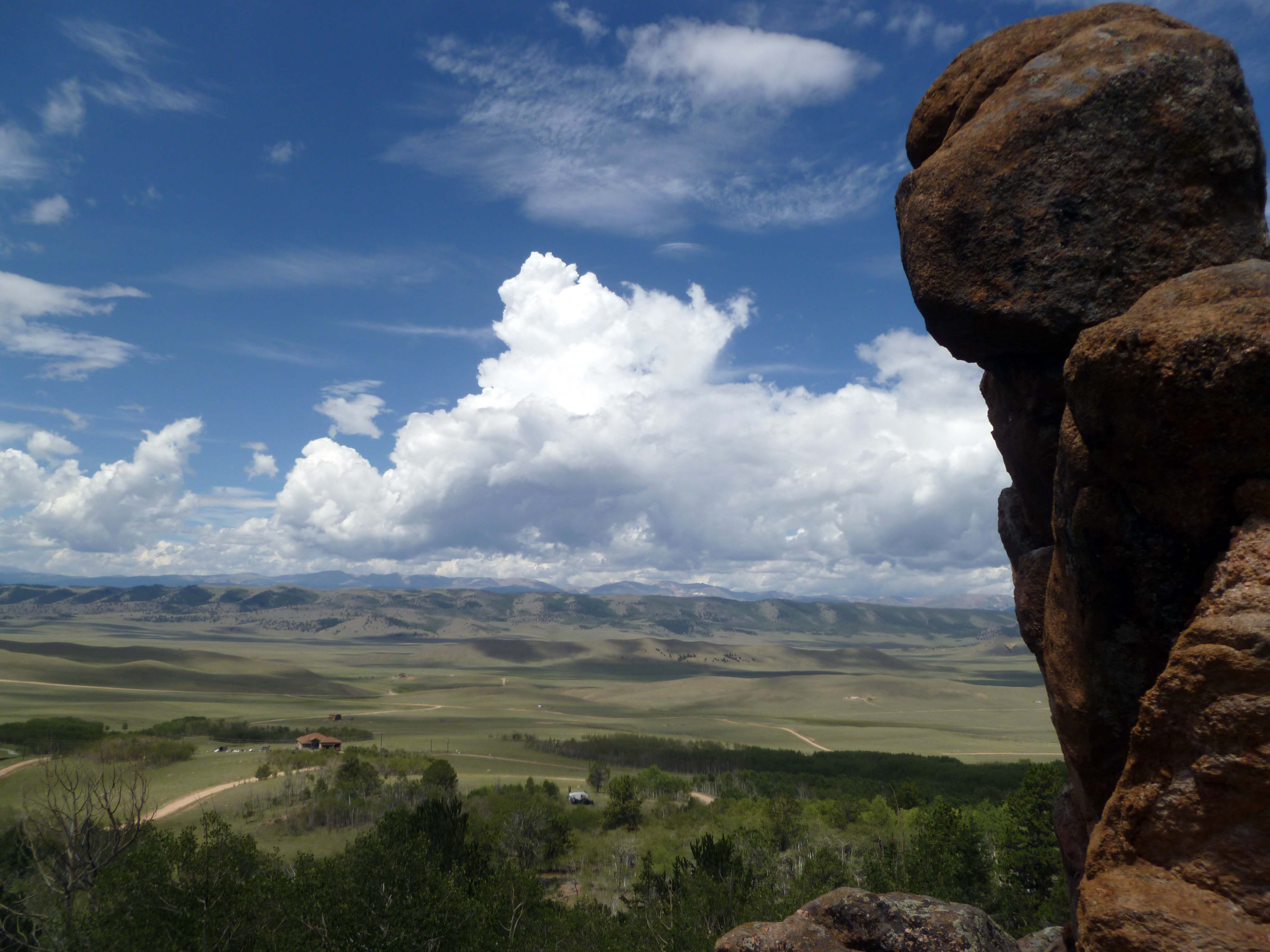
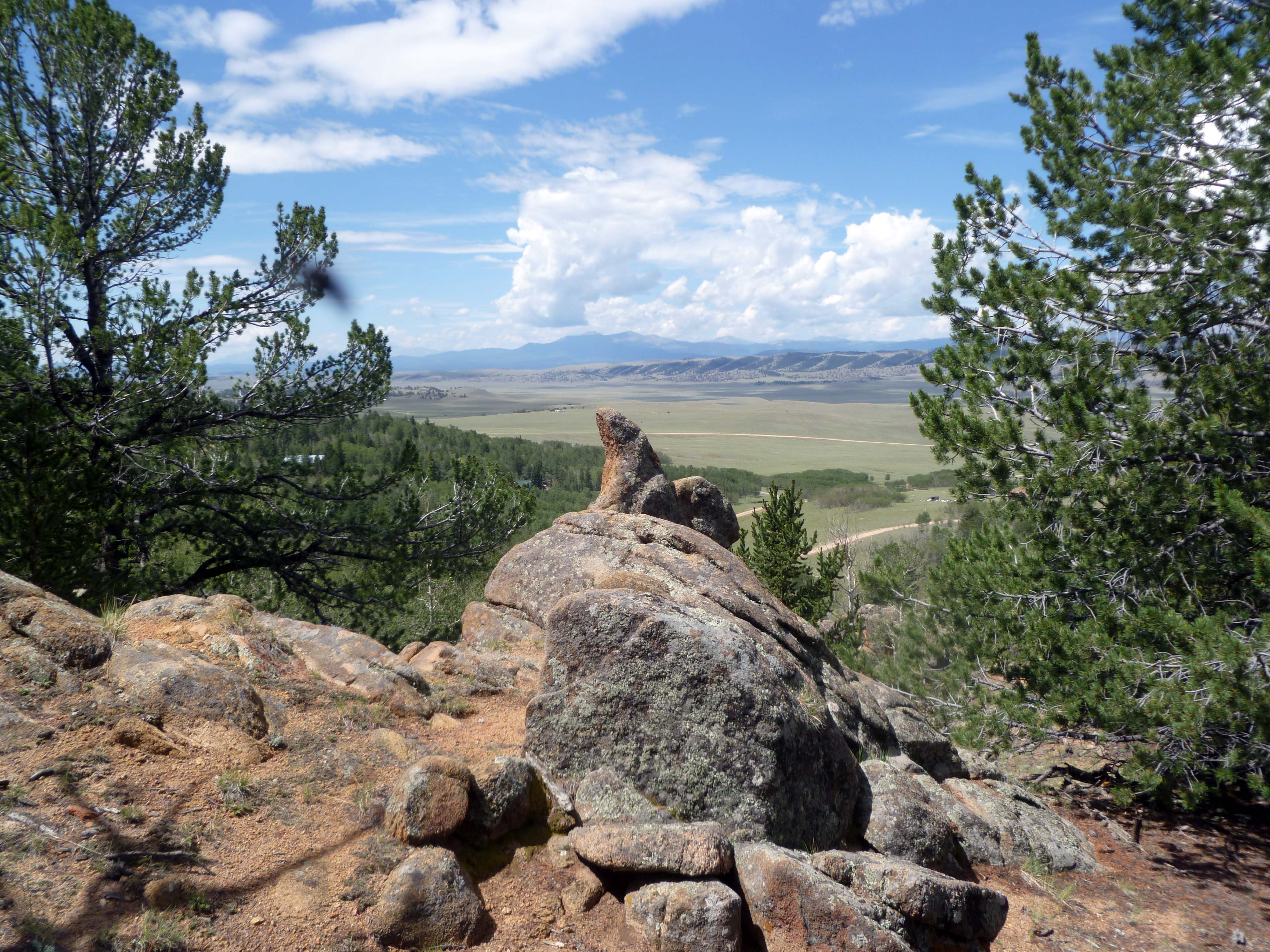
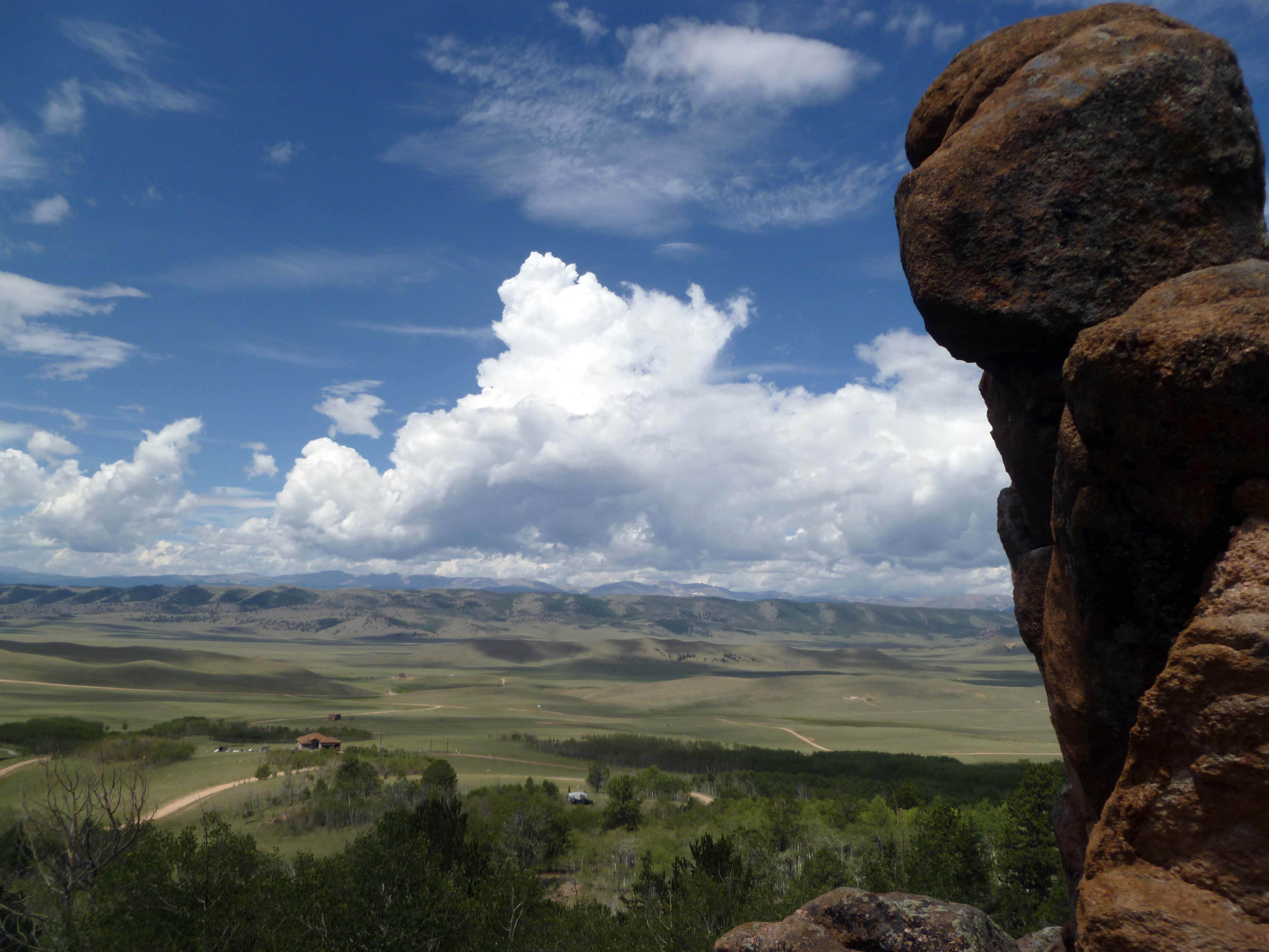
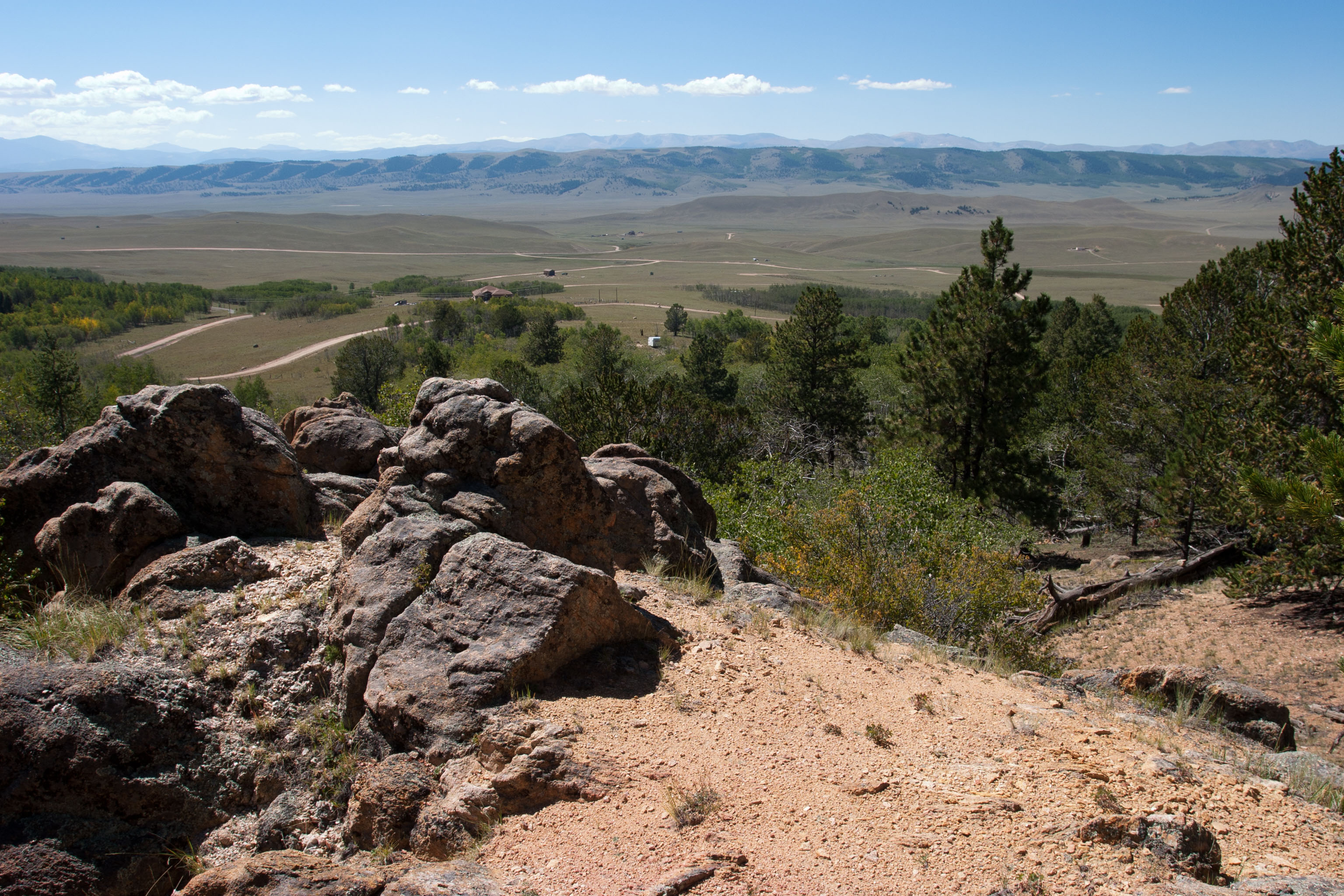
This rock outcropping is at the back of the lot. I’ve named it Squirrel Rock due to it’s shape. The realtor and I walked the lot’s perimiter and found all the corner stakes so I know this rock is part of the 7 acres that make up the listing.

Rock outcropping at the back of the lot.

Views from Squirrel Rock:

View #1 from the back of the lot.

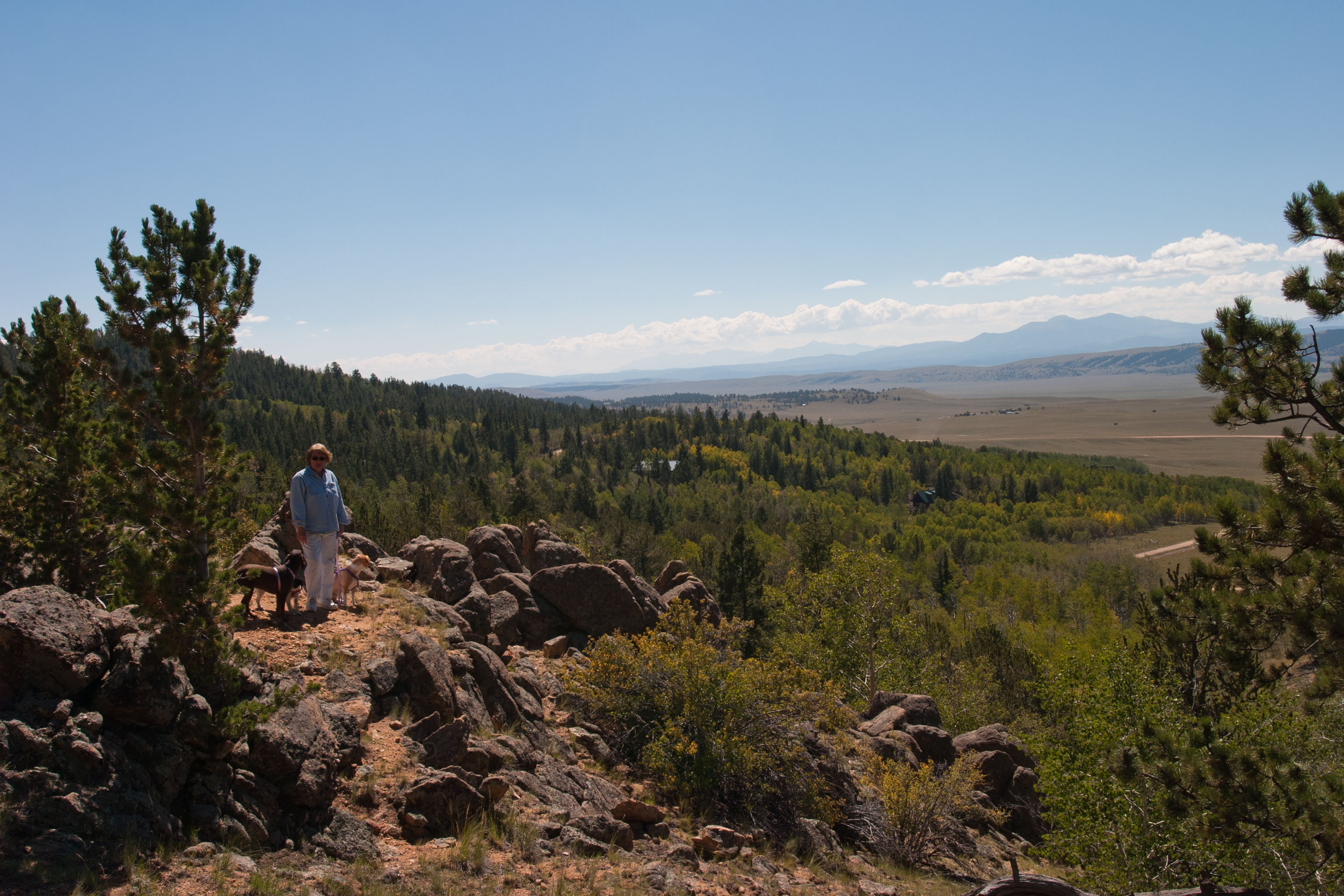
View #2 from high point of the lot.

View from the cul-de-sac where driveway would meet the county road. (Taken last spring with a telephoto setting.)  I am standing where the driveway would meet the road.

Pam on cul-de-sac near proposed driveway.

The view from the bottom of the lot is not bad, either.

View from the bottom edge of the lot.

Over the last 2 years we have looked at hundreds of lots. Some were flat, some steep, some pleasant, some over our price range, some we wouldn’t buy at any price. Some had houses, some had buildings, some with no views, some with spectacular views. This one is the best all-round lot we’ve found.

How do we feel? We are convinced this is a good lot for us, and are looking foward to owning it. We have already planned out where the driveway would go, where a house would sit, where my shop would be, and have visions of the lot with the trees thinned and the dead wood removed. Lots of work, yes, but very satisfying work. I can see us on the lot, smelling the warm pine, looking out over South Park to the distant mountain range, and sipping a beer between jobs. 🙂

Pam’s brother Larry had an interesting suggestion: Mount a camera on Squirrel Rock and pipe the view into the internet. Call it Pam’s Cam. Have access to those views any time we want without the steep uphill climb. Good idea!

There are plenty of details to plan out with an empty lot, including how to get power, telephone service, garbage pick-up, and just carving out a place to park a car. Off-grid may be an option for power. It remains to be seen if Pam and I are up for all the challenges developing this property will bring.

The next post should be, I hope, announcing that our offer has been accepted and a closing date set.

We are excited. Finally we can move forward in our plan to acquire recreational land, a goal we set 2 years ago and are now almost there!

That’s it for now. Thanks for looking in!
3 dogs

(Click on the photos to bring up larger images.)
Our 3 dogs taking it easy one afternoon.

Tired Blondie

Tired Blondie

Poor Blondie. So tired she can hardly wag her tail.

Road Kill Bru

Road Kill Bru

I cannot imagine this position being comfortable, but Bru rests like this fairly often. She likes the open window. (What, you thought I would mention her legs?)

Jo and her toys

Jo likes to have a toy (or two, or three) around her when she takes a nap. Since Blondie and Bru had taken over the sofa, Jo is forced to rest on our couch.

Ah, to lead a dog’s life in this house…

That’s it for now. Thanks for looking in!
Latest land hunt, tractor update, miscellaneous items

This post is going to cover a variety of topics. First on the agenda: Our latest land hunt.

On July 4th Pam and I returned to the  Fairplay and Lake George areas to check out some properties we had seen on-line. These 4 all have some plusses and minuses and overall we enjoyed seeing them.

First up was this small cabin near Fariplay on 3.3 acres. Located on a cul-de-sac and with a spring, the views were pleasant but not dramatic. No running water or electric. Lots of Aspen trees.

Small cabin on 3.3 acres

Small cabin on 3.3 acres

The views from the lot overlook South Park and are pleasant:

Views from small cabin lot

Views from small cabin lot

We marked this one as a possibility, but it didn’t really ‘speak” to us as our dream lot.

The next place we visited, near Lake George, is a 10 acre lot with a couple of cabins on it.

10 acre Lake George lot

10 acre Lake George lot

This lot is the best we have come across in a while. It has a good mix of pine and Aspen, is gently sloping, has two wells and a septic in place, and access is very good. Views are not great from the lot but not bad from the access road. There are 2 small cabins on the property, one has water and the other does not.  Electricity is on the lot.

One cabin on the Lake George lot

One cabin on the Lake George lot

There must be more to the story of this lot than meets the eye. Why are there 2 wells on the property, and we found what appears to be an easement to a property behind this one. The other cabin is in sorry shape as is a small storage shed near it. The lot “spoke” to us, the cabins also spoke to us – they said “tear us down!”  We may explore this one a bit more, but only as a lot. The cabins would have to go and a new place built closer to the meadow area.

The 3rd stop of the day was to visit an off-grid cabin that sounded interesting, and it was.

Off-grid cabin

Off-grid cabin

Located off the side of a side road, this cabin has a great deal of  charm. It has lots of trees, a hand-pump well, a great deck, and overlooks a meadow. Down side is the driveway into it is steep and electrical service is quite some distance away. I didn’t realize quite how steep the drive was until I took this photo of Pam hiking it on the way out:

Driveway into off-grid cabin

Driveway into off-grid cabin

Note how the top of the drive is still above Pam’s head! Winter access would be problematic at best (think ski tow…). For all of that this is an appealing cabin. Now if we could just put it on the Lake George lot…:)

The last stop of the day was to see a cabin that seems close to what we would like to eventually have for ourselves. This neat and tidy place is for sale near Fairplay.

Neat cabin

Neat cabin

Located on several acres, the owners of this place have thinned some of the trees and cleared all underbrush, plus put up a neat and tidy cabin. Obviously a weekend get away place, the cabin has a nice storage shed behind it. Overall this appeals to our Midwest sense of tidiness and order.   No view at all, however.

Some of the cabins we’ve seen have hand-pump wells. This place also has one, converted to run from an electric motor.

Converted hand pump

Converted hand pump

I am familiar with these conversions, called pump jacks,  from my childhood as they were common on farms in central Wisconsin. It has been a while since I saw one in operation, though. Generally either a hand pump or a converted hand pump indicates the water level is not that far down. Over the years most of these installations were converted to modern well pumps. Still, it adds a rustic note to this property and is probably quite functional.

We liked the Lake George lot the best, but the asking price is well over our budget. We plan to watch the property and see if the price drops at all. We will do some follow-up research on the easement and history of the cabins.

We just wish we could find “the place” that has a cabin (or just a nice mostly level and treed lot) within our price range. Oh well, champaign taste on a beer budget. We just have to get lucky!

Other topics and notes:

We are finally getting some rain after one of the hottest and driest month of June on record. Most of the fires that have been burning are out or contained. One bummer side effect for me: the BLM has closed the Wild Horse Mesa area to public use. That’s where I did most of my ATV riding.

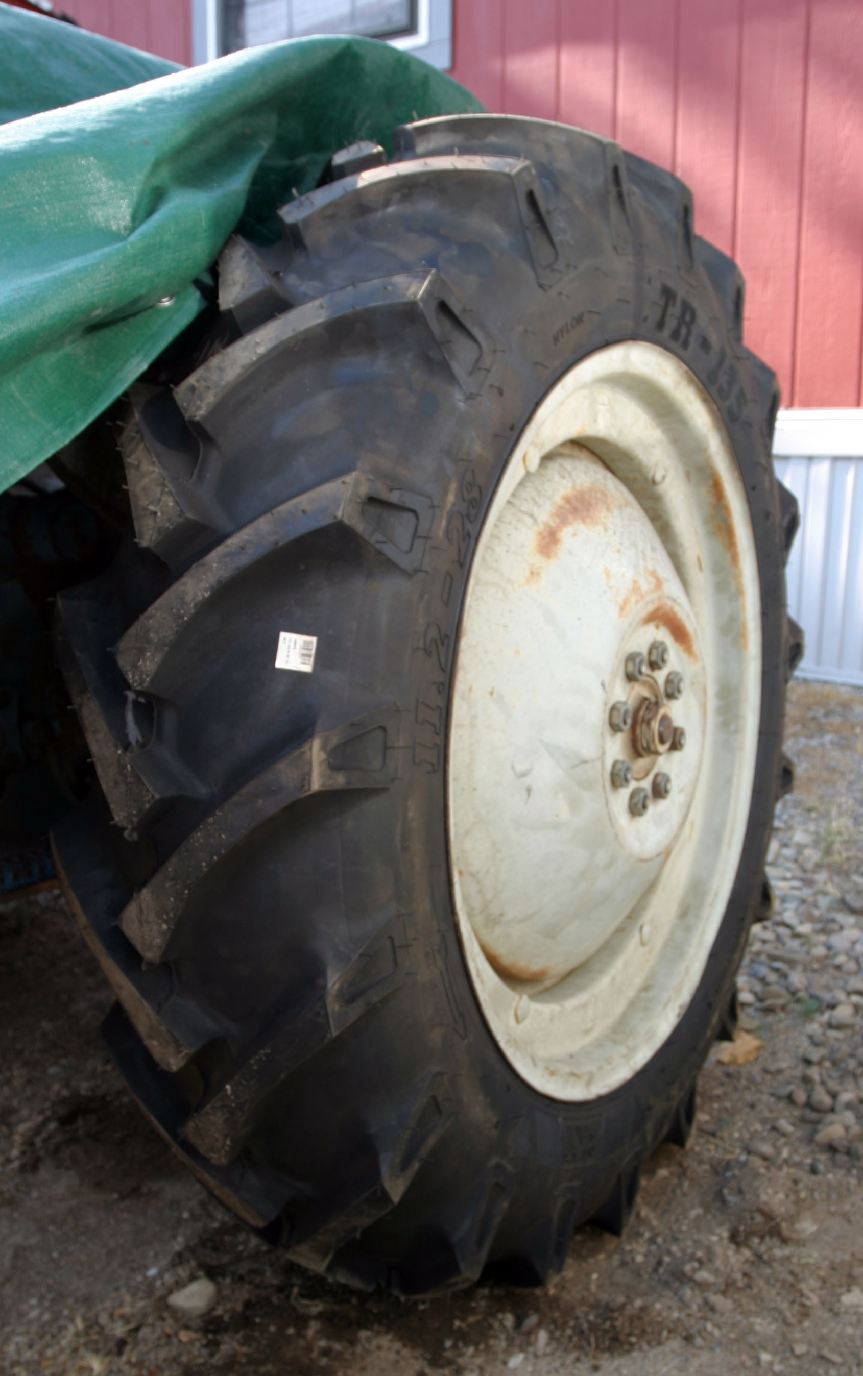
I have been working on my tractor. More bad news: After I bought a used set of tires and parts, I tore the valve stem out of one of the rear tires. In trying to fix it the tire shop poked a hole in the tire. Not uncommon for a tire this age due to the tires getting old and brittle,  but it leaves me with no left rear tire. I am not happy about this, but that’s the way it is. For a few days I did have a tractor that could move around on 4 tires that didn’t go flat. Now I am looking for another rear tire.

Bringing home tractor parts

Bringing home tractor parts

We are as busy as ever and time seems to go past quickly. Hard to believe the summer is half gone already!  September marks the two year point in our land hunt, time flies when you’re having fun?

That’s it for now. Thanks for looking in!
 

Fire Finale

Yesterday I took my ATV out to view the damage caused by the Pine Ridge Fire, which at one point threatened to evacuate us from our place in DeBeque. While fire is a natural component of forests and woodlands it is hard to look at (and smell) the damage.

Burned hillside

Burned hillside

The closest point of the fire to DeBeque, by a twisty road, was about 7.25 miles. As the crow flies it was closer than that.

One predicted side effect, erosion, has already started to take place. We did get a light rain in the area, and this mud flow across the access road shows what a little water, with no vegetation to trap it, will be doing to hillsides throughout the area.

Mud flow across access road

Mud flow across access road

Good thing my ATV has 4-wheel drive. Some of this mud is extremely gooey.

Here and there you can still see traces of the red fire retardant dropped by the slurry bombers.

Red fire retardant paints some rocks

Red fire retardant paints some rocks

I had mentioned in previous posts that one concern was loss of electrical power to the town. As you can see from the next couple photos the power lines were damaged. Hopefully the utility company has re-routed power from these lines or we are still at risk until repairs can be made!

Burned-off power pole

Burned-off power pole

The fire came right down to the railroad tracks that border I-70. Here is another shot of the damage.

Burned-off power pole

Damaged cross-beam

As bad as the fire was, there are still some bright spots. Very near where the power lines were damaged this patch of small sunflowers is making a bright yellow statement.

Sunflowers survived and brighten up the landscape

Sunflowers survived and brighten up the landscape

For the time being all local fires are out. The recent rains have helped some but open fires of any type are still banned as the underlying dryness is still very much there. Our tension has reduced a great deal.

Over 13,000 acres burned, but here and these a tree or two survived. Some have burned lower limbs but their tops are intact. Maybe these damaged trees can make a comeback and serve as the source to re-seed the area. The part that gets me is how completely the ground cover burned. Hard to believe this area can return to it’s pre-fire condition in our lifetime but we will be keeping an eye on it over the next few years to see what progress Mother Nature can make.

The burned area is generally south of where I’ve seen the wild horses so I think they came out OK. i did see a few rabbits and a salamander or two. It is hard to imagine how they survive events like this!

That’s it for now. Thanks for looking in!
Fire report for July 5. One down (mostly) and another springs up

The Pine Ridge Fire, which at one point had us wondering if we would need to evacuate, is now contained. Here is part of the press release that describes the current situation:

Current Situation

Total Personnel 213
Size 13,920 acres
Percent Contained 100%
Fuels Involved Timber with grass understory, Pinion-Juniper, sage brush
Fire Behavior Smoldering
Significant Events 100% Contained at 1800 Wednesday, July 4

Outlook

Planned Actions Transfer of command to the Type 4 organization will occur at 0600 7/5/12. Suppression actions will include continued mop up and patrol.

So, aside from mop-up operations, for all practical purposes the fire is no longer a danger. That is a relief! Still there seems to be no rest for the weary. Pam and I returned home from a land hunt trip yesterday, July 4, and thought we noticed a difference in the smoke pattern. The smell of smoke was stronger than it had been in a couple days. Reason: Another fire in the area. This one is not big enough (yet) to get listed on the web page at www.iciweb.org, but here is what the latest press release has to say about it:

******************

July 5, 2012

11:15 a.m.

Fire Works Firefighters on July 4th

De Beque, Colo. –  Lightning caused firefighters to work on the Third Water Springs Fire approximately 25 miles up Roan Creek Road on Kimball Mountain northwest of De Beque.

The fire was reported at 1:15 pm yesterday.  It is currently estimated to be roughly 150 acres in size.

There are seven engines, one water tender, five Type II crews, air attack, and two helicopters (one Type II and one Type III) on scene this morning.  The fire is burning in a steep, mountainous area of Garfield County in grass and pinion-juniper vegetation. The fire is burning on Bureau of Land Management public lands.

There is no current containment on this fire.

********************

Our prevailing winds are from the northwest so the fire could move toward us should the winds pick up. The one saving grace is the weather; humidity is up a bit, winds are down, and the forcast for the next few days includes a better-than-even chance of rain. We are not worried about this fire, but cautious just the same.

I’ll have more on the land hunt trip in my next post, which I hope to get done this weekend.

That’s it for now. Thanks for looking in!


Fire Update, July 2nd

Well, the fire is still burning.

It has grown to over 13,000 acres, and still impacting our town of DeBeque. While the plumes of smoke have decreased we still smell the smoke in the air and see the aircraft and helicopters flying overhead as they make their way to and from the fire’s perimiter. Hotshot crews are still in town and the local high school is still active as the incident command center.

The fire is getting a lot of local media attention. We have nightly live reports from the TV stations in Grand Junction, and some updates are being posted in Garfield County media. (The fire is in Mesa County. Garfield County is the next county to the east.)

We have returned to a more natural frame of mind. This last weekend we did all our normal things, like mowing the lawn, grocery shopping, and chores around the house. Talk of evacuating the town is no longer heard, and the small area that had been evacuated in case the fire jumped  I-70 had the evacuation order lifted. People could return to their homes, and no homes or property were damaged.

The greatest concern for DeBeque is loss of power if the fire spreads into the area of the power lines. These come out of Grand Junction and follow the Colorado River up to DeBeque. The fire is heading south-west toward these lines, but it seems the fire is on top of the mesa and not along the river proper, thus staying away from the lines for the moment.

Some of the media reports have been inaccurate, such as the one in the Glenwood Post Independent that said residents had been evacuated from east of DeBeque. Not true.  We are about 32 miles from Grand Junction, although the towns of Palisade and Clifton are a few miles closer. One site put the fire 13 miles from Grand Junction, which would put the fire some 9 – 10 miles  from DeBeque instead of the actual 2 – 3 miles. I-70 runs more-or-less east and west, but does take some turns north and south as it follows the Colorado River. It seems odd to read phrases like “east of I-70” or “west of I-70” when, to us, the directions are north or south of I-70.  Oh well.

That’s about it. Although the fire is still burning, and is only about 35% contained at this time, it has dropped from being a concern for us. Life has pretty much returned to nornal.

That’s it for now. Thanks for looking in!
Not burning, for now

Pam and I have received several calls and e-mails regarding the Pine Ridge Fire burning very close to our current residence in DeBeque. Our status: we have not been evacuated nor does it look like we will need to evacuate. (You can check for updates at www.inciweb.org. Look for the Pine Ridge Fire link.)

In this case the fire  was caused by lightning. The fire moved quickly, fueled by dry vegetation, low humidity (single digits) and moderate to strong winds.

Last night there was a community meeting to discuss the fire, including evacuation preparations. A small residential area was evacuated in case the fire jumped I-70, but that section is about 2 miles from our house. It is this evacuation notice that seems to be causing great consternation with our friends!

A back fire was begun last night and was sucessfully completed this morning. This created a safety zone between the town and the main fire. There are 2 major concerns: flying embers causing house fires and power outages as the town’s power lines run though the fire area and may be damaged or destroyed.

The first concern, structure fires, has been addressed with extra fire trucks and crews stationed in DeBeque. These crews and trucks are on the move around town and seem to be in plentiful supply.

The second concern, loss of power, has not happened yet but is still a real possiblity. Since the wires could actually burn up, replacing them would be a multi-day project. In the interim, no power for refrigeration, air conditioning, or town pumps. We have a small generator that is  large enough to power the refrigerator (we have no freezer) and a fan or two and a couple lights. We could get by. The town has back-up generators for the water plant so we assume water would still be available.

Today was the make-or-break day. With the sucessful back fire and additional trucks and crews in place it is unlikely we will have to evacuate, but that is still a possibility. There is smoke and ash in the air, and I-70 has been closed periodically. Helicopters are grabbing water from the Colorado River along I-70 and officials don’t want them bumping into road traffic. The volume of smoke and ash has been decreasing as the day goes on, a good sign the worst is over.

Here are a few photos of the smoke plume as taken from the I-70 and DeBeque interchange and from our back yard: (DeBeque is about a mile to the right of this interchange.)

Wednesday evening from I-70 interchange

Wednesday evening from I-70 interchange

Wednesday’s smoke plume from our back deck

Thursday’s smoke from our back deck

Thursday’s plume of smoke from I-70

Plume of smoke in the sky

We are still watching this closely, but wanted to let everyone know we are OK, have not been evacuated, and by the look of things right now, won’t have to evacuate.

Several local friends have offered their facilities for us to use should the need arise, and we greatly appreciate these generous offers! Should anything else develop we will be in contact with our children Felicity and Toby and will try to add a quick post to this blog.

Thanks to all for the calls and concern. They are greatly appreciated by both of us.

That’s it for now. Thanks for looking in!
« Older posts Newer posts »

© 2026 AppleAttic Blog

Theme by Anders NorenUp ↑